Cloud cover is moving north Tuesday evening and moisture is building back into the region. This is all out ahead of a cold front that will be moving in Wednesday night into Thursday.
On Wednesday enough moisture moves in for some showers and storms. There could be a few locally heavy downpours providing some much needed rain. There could be a few lingering showers early Thursday until it moves through.
At the moment it looks like the rain will be scattered around the area. Expect areas of showers and storms through the day so it won’t be raining all day where you are but we will see rain somewhere around the area through the day. Highs will be in the low 80s Wednesday and then mid 80s Thursday.
After that fall weather moves back just in time for the end of the week.

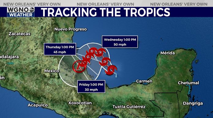
Tropical Storm Karl formed Tuesday afternoon in the southwestern Gulf and Bay of Campeche. This system is from the area of potential development we have watched the past couple of days moving across the Yucatan. It is actually part of what was Julia that broke off and moved northwest.
Karl will continue to meander around the southwestern Gulf through the week before moving inland along the central Mexican coast. This will not be a threat to our area or anyone in the northern Gulf.


