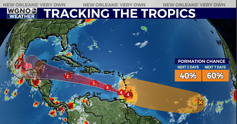
NEW ORLEANS (WGNO) — Hurricane Beryl is back to a category 4 storm Monday morning with winds of 130 mph as it moves quickly west at 20 mph. This movement will continue through the week as it passes through the Caribbean.
The latest forecast track is basically unchanged. Right now it looks like this system will move west into the Yucatan Peninsula, weakening a bit as it does so. It will then re-emerge in the southern Gulf over the weekend.
At the moment there is no reason to be concerned for the northern Gulf. However with this storm still so far away there is plenty of time for changes to happen to the steering currents and the forecast track. Continue to watch this closely through the week.
The biggest impact on the track will be a ridge of high pressure sitting over the southeastern U.S. It looks like this ridge moves east and weakens a bit by the weekend, likely allowing Beryl to turn to the north. Timing on that turn will need to be watched through the week since it is still so far away.

We will also be watching the tropical wave behind Beryl which currently has a 60% chance of development over the next 7 days. This will likely be our next named storm, and may have a bit better chance of lifting north in the Caribbean.
Stay up to date with the latest news, weather and sports by downloading the WGNO app on the Apple or Google Play stores and by subscribing to the WGNO newsletter.


