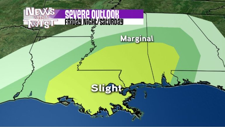
NEW ORLEANS (WGNO) – After heavy rain Thursday, we only get a brief break from storms during the daytime hours on Friday.
The Storm Prediction Center has placed our entire viewing area under a slight risk zone for late Friday night (and into the early AM hours of Saturday), and also for the daytime, especially around Saturday evening.
There is a strong possibility that Saturday evening’s risk potential will be upgraded to enhanced, or even moderate risk for severe storms Saturday evening.
It will be warm and windy through the day on Friday, and the more sunshine we see, the higher chance for severe storms Friday evening as it destabilizes and heats the atmosphere. Friday’s potential will likely between 10 p.m. and 2 a.m., but is a evolving scenario.
Severe weather would include hail, damaging winds and the possibility of tornadoes. While it will be dry during the day Friday, a tornado or severe thunderstorm watch will likely be issued by early evening in the anticipation of later storms.
Saturday will also be warm and windy, with periods of dry weather. Scattered thunderstorm cells will likely form earlier in the evening than Friday night and may pose a greater threat for severe storms. A second tornado watch will be likely issued Saturday mid-afternoon.
Download the WGNO Weather App free from Google Play or the App store for interactive radar and severe weather push alerts sent to your phone or iPad. The WGNO weather team will be monitoring the situation through the weekend and posting as needed.


