2017 is quickly becoming a very active season in the Atlantic Basin. Several systems are in the Atlantic at the moment with the potential to develop further.
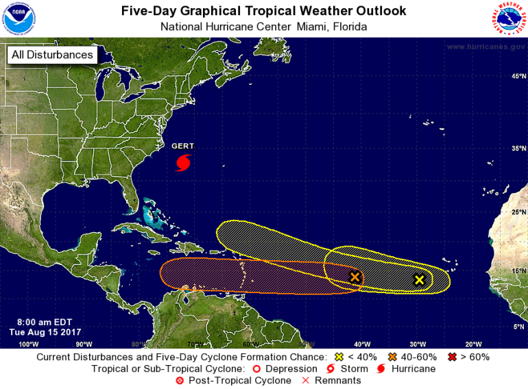
The storm closest to the U.S. is Gert. That became the second hurricane of the season on Monday. Gert shows signs of strengthening but will stay offshore from the east coast and only create a rip-current issue along the beaches.
However there are several tropical waves that have come off of Africa to start the week.
 The National Hurricane Center is currently tracking three additional waves. The first of which is listed as a medium chance of development over the next 5 days. This system right now appears to be staying further south and west. This could bring the system into central America, but it’s still too far out to guarantee.
Two additional tropical waves have a low chance of development in the next 5 days. However those have the chance to become better organized as they move west-northwest.
The important thing to remember is the peak of the hurricane season averages on September 10th. That’s still a few weeks away, and you need to have preparations in place should a storm come into the northern gulf.

