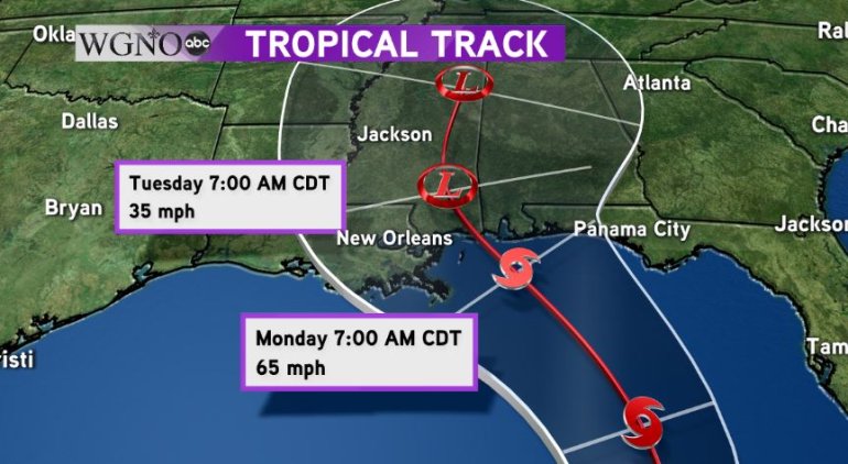
NEW ORLEANS — Sub-tropical storm Alberto formed just south of the Gulf this morning and is expected to move into the Gulf overnight with its sights set on the Northern Gulf Coast this holiday weekend.
With the threat for Alberto growing as the storm continues to develop, the National Hurricane Center has issued a Tropical Storm Watch for the Gulf Coast from Grand Isle eastward to Indian Pass, Florida. This does include Lake Pontchartrain and Lake Maurepas.
A tropical storm watch means sustained tropical storm force winds in excess of 39 mph are possible in the watch area within 48 hours.
While the storm continues to move towards the coast, its effects will take a bit of time to arrive. Expect the normal summertime pattern of scattered showers and storms on Saturday with high temperatures in the upper 80s.
By Sunday, we will have a little break with some dry gaps and not as many showers and thunderstorms. The biggest impacts from Alberto are set to arrive on Monday, Memorial Day, into Tuesday.

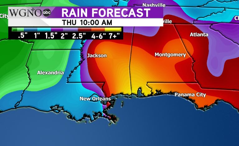
Alberto is expected to make landfall early Monday morning near Mobile Bay in Alabama. Areas north and east of landfall could see 4-6″ of rain from this system.
While it does not appear that New Orleans is in this area at this time, if the path shifts westward, even to the slightest degree, it could bring that heavy rain into the city and surrounding areas.
The South Shore, Coastal Mississippi, St. Tammany Parish and Southern Tangipahoa Parish are under a flash flood watch until Saturday at 7pm due to the increased chance of rain though Saturday. This is not associated with Alberto. Numerous showers and storms are possible on Saturday and the ground is already saturated from previous rain events this week.
If the storm tracks farther west, the flooding potential would become much worse.

The WGNO weather team will continue to monitor Alberto as it continues to churn into the Gulf of Mexico and will bring you the latest updates on-air and online.


