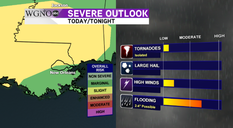
NEW ORLEANS – A strong line of showers and thunderstorms will roll across the central Gulf Coast this evening and into the overnight hours, bringing with it the threat for flash flooding, isolated tornadoes, and damaging straight-line winds.
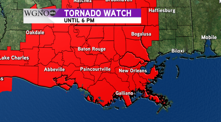
A tornado watch is currently in effect for our area, except for Hancock County, MS until 6pm this evening

A cold front pushing into western Louisiana will slow down as it begins to run into a high pressure system in the Atlantic and eventually stall out over the area. Ahead of the front, there are ample amounts of warm air and moisture for the system to work with, and that translates into 2-4″ of rain possible over the next 24 hours. The ground is already saturated from last night’s rain. Because of all this, a flash flood watch is in effect for the entire viewing area through tonight.

After this morning’s break from the showers, expect scattered showers to develop during the early afternoon and through the evening hours ahead of the main line of storms. The main threat of severe weather tonight is on the North Shore and includes an isolated tornado and damaging-straight line winds in excess of 60mph along the leading edge of the line of storms.

Behind the storms, heavy and widespread rain will push into the area. The concern is how slow this system will move. The latest models indicate it will take several hours tonight for the entire area of moisture to move across and out of the region into Alabama.
After the rain leaves early tomorrow morning, continue to expect scattered showers and maybe an isolated rumble of thunder for Friday with highs in the lower 70s. It doesn’t look like the front will actually push through and begin to clear out the rain until sometime next week.


