Tropical storm Sally continues to strengthen Sunday morning with coastal Louisiana and Mississippi in the path for significant impacts. The latest hurricane center forecast has this as a category 2 storm now with winds reaching 100 miles per hour.
Hurricane warnings and storm surge warnings are in effect across the area.
The slow moving nature of this system near landfall will create additional storm surge and heavy rain issues. Expect widespread power outages due to prolonged tropical storm and hurricane force winds.

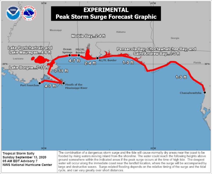
7-11 ft of surge is now possible from the mouth of the river to Ocean Springs, MS with 4-6 feet expected over the lakes. Move away from coastal areas and inside the levee system.

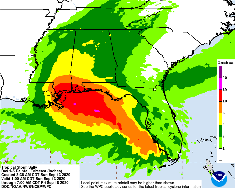
Locally heavy rainfall amounts of 10-15 inches or more will be possible east of the center of the storm. It is going to be a tight gradient so where the center makes landfall will make a big difference. Areas from New Orleans and east though should prepare for the threat of rainfall flooding.
This will be a significant impact to the area. Perhaps the biggest since Katrina. Have supplies on hand and be prepared for several days without power. You should consider moving inland from coastal areas before Monday afternoon.


