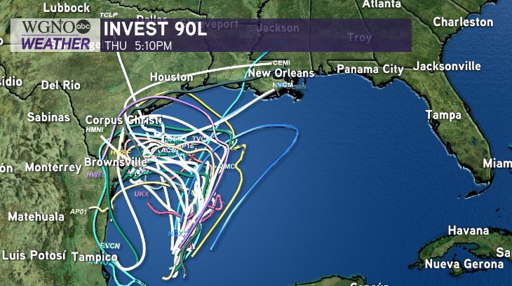
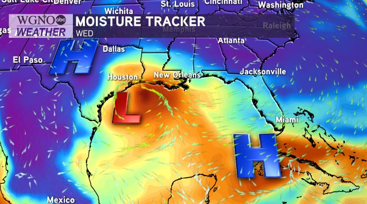
After a very active week forecasting for Hurricane Laura, the National Hurricane Center is monitoring development potential of Invest 90L in the Southern Gulf.
Advisories on Tropical Depression 22 or Tropical Storm #Wilfred are a possibility later today to early tonight. Right now, no imminent concern, but this is worth monitoring into next week.

A special outlook is issued for Invest 90L in the southwest Gulf of Mexico and Bay of Campeche. Tropical Depression or Tropical Storm #Wilfred likely forms as a 90% chance of development remains possible over these next 3-5 days.
This is a system that will stall all week until the weekend. Again, in the short term, no imminent threat around our northern Gulf Coast, but we will have to monitor it closely by the early part of next week.
Stout high pressure will keep the disturbance trapped in the South Gulf the next ~2 days, with most guidance meandering the likely future depression or tropical storm in the southern Gulf. Some models even kill it off while moving into south Texas or Mexico.

After that point, things get a little more tricky. By late this weekend through early next week, the system may begin to move northward. Forecast models widely vary on how far north the system will get before another ridge of high pressure builds in, potentially shunting the system back west.
What does that mean? We could be talking about this future storm for quite a while, even into the middle or late part of next week. Very heavy rain is expected to fall over the Gulf of Mexico, fortunately, with most of the rain offshore these next five days. Expect these numbers to fluctuate as the forecast becomes more clear.


