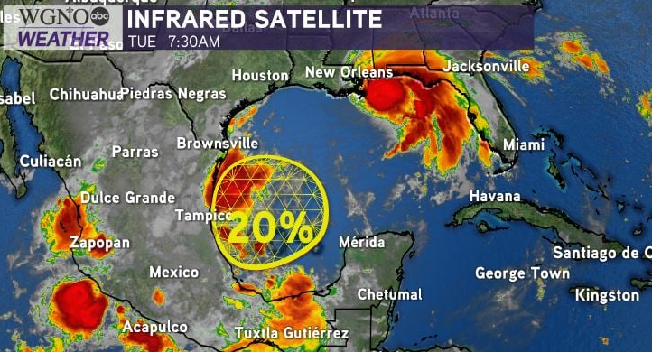
A tropical disturbance in the southwest Gulf of Mexico has low chances for formation and development within the next 3-5 days but will be worth closely watching. National Hurricane Center meteorologists are eyeing a low pressure system producing disorganized storms, thunderstorms, and showers just off of Mexico’s coastline.
Generally, model guidance shows this is likely to remain in the Bay of Campeche and southern Gulf, staying trapped before moving toward southern Texas as it keeps low, 10-20 percent chances to materialize. Nonetheless, any disturbance near the Gulf of Mexico is worth closely monitoring during peak hurricane season in September.
There is only one name left on the 2020 Atlantic Names list before the Greek alphabet—used last during the 2005 hurricane season, which spurred Katrina.

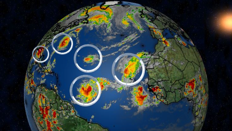
Yesterday marked the first time five named storms were in the Atlantic Basin at once in 49 years. The National Hurricane Center has not issued advisories on this many named storms at a time since 1971. Paulette, Rene, Sally, Teddy, and Vicky set a record for most named storms at once in the Atlantic Basin.
Right now, no other areas are of concern locally as Hurricane Sally continues progressing east of New Orleans ahead a Gulf Coast landfall. Pay attention to forecasts for the upcoming week.


