Enjoy our last warm forecast for quite some time as you’re watching the Saints versus Packers game! Who Dat?! Conditions will be beautiful if outside at a restaurant or home!
It felt more like 90s than 80s earlier today based off of humidity and actual temperature working together to up real feels!
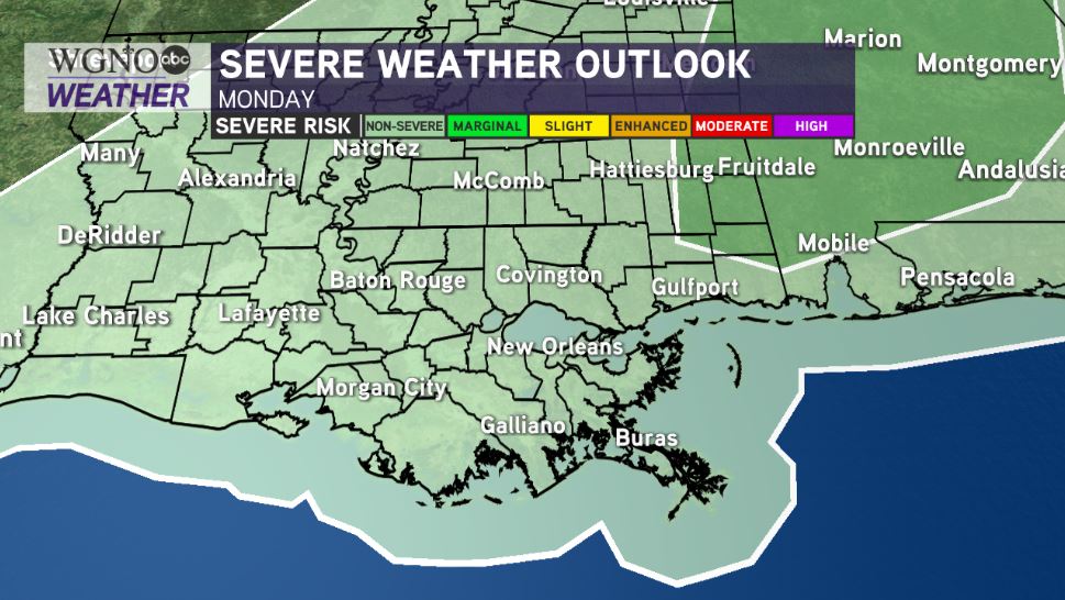
Monday, rain in our area returns along this much anticipated cold front! By late afternoon after lunch, storms pop up and will mostly be below severe limits.

Storm Prediction Center meteorologists have issued a Marginal Risk across much of Alabama. Have ways you can receive warning information on hand, locally, too, to be safe!
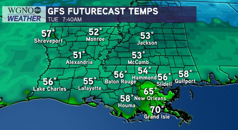
Anticipate 80s ahead this system but pack another layer because 60s will be becoming Louisiana’s reality by Monday night.

Northshore residents likely wake up with 50s outside their windows Tuesday morning! This is the real deal as highs will stay near mid-upper 70s all week!
Climate Prediction Center outlooks show temperatures will be below average during October’s start! What a different story from last year as we were breaking record highs nearly daily when fall immediately began!
We are keeping a close eye on the quiet tropics as October approaches. No potential for formation is anticipated in open Atlantic waters these next few days, but the season is not over until it’s over on November 30th!
Enjoy indulging in sweater weather! We have a 100% chance of Meteorologist Scot Pilie issuing his Gumbo Warnings soon! ‘Tis the season!


