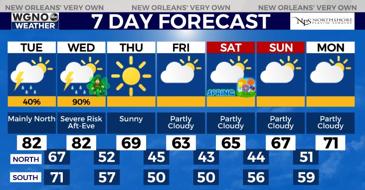
7:00AM VIDEO FORECAST from Meteorologist Scot Pilie — Few thunderstorms Tuesday, mainly north of Lake Pontchartrain. Can’t rule out a few localized heavier pockets of rain, similar to what we encountered Monday. Monitoring severe threat St Patrick’s Day. Here’s the breakdown:
![]() Heads up
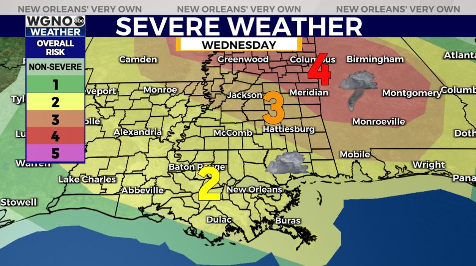
Heads up![]() Severe weather outbreak possible across parts of the Gulf South on Wednesday-Wednesday night for St Patrick’s Day. Moderate (Level 4 out of 5) Risk for much of central Mississippi/Alabama. Slight Risk(Level 2 out of 5) for much of South/Southeast Louisiana.
Severe weather outbreak possible across parts of the Gulf South on Wednesday-Wednesday night for St Patrick’s Day. Moderate (Level 4 out of 5) Risk for much of central Mississippi/Alabama. Slight Risk(Level 2 out of 5) for much of South/Southeast Louisiana.
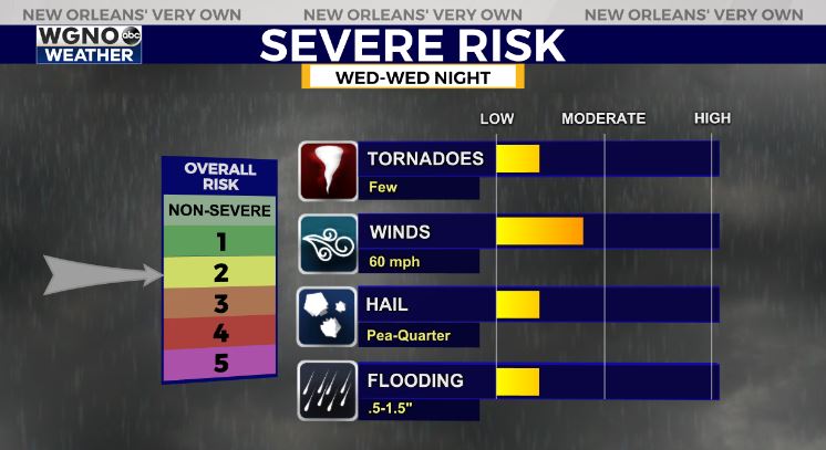
All forms of severe weather appear possible including damaging winds, large hail, & tornadoes.
At this point, ingredients and best dynamics for severe weather appear north of the I-10/I-12 corridor.
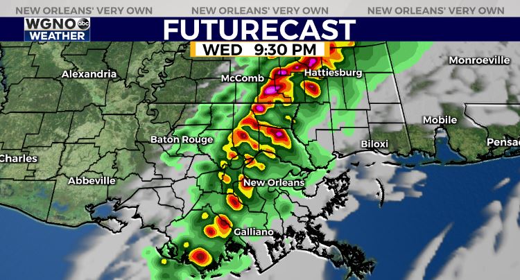
Time frame: Scattered hit/miss storms mid day into early afternoon with isolated severe storm on the Northshore. Highest rain chances late afternoon-midnight.
Worth closely monitoring as guidance grasps a better handle on storm track/ingredients for severe weather. Stay tuned!


