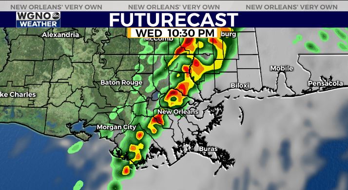
Strong to severe storms will be possible Wednesday night as strong cold front moves across the area. Out ahead of the front we will continue to see warm and muggy conditions with highs back in the low 80s on Wednesday. Look for breezy conditions again as well.
The line of storms will be working across the area after sunset Wednesday from the west to the east. Look for locally heavy downpours along with a severe weather threat.

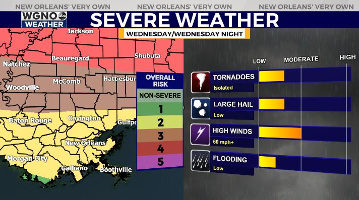
That threat will include isolated tornadoes and strong wind gusts as well as large hail. As is usually the case the higher chance of severe weather will be to our north. We could see significant severe weather along the I-20 to I-40 corridor.

The northern part of our viewing area is in the level 3 risk outlook. Everybody should stay alert to weather conditions Wednesday and be prepared to take action is a severe storm is threatening you.
Check out current conditions near you: https://digital-staging.wgno.com/weather/new-orleans-weather-radar/
Stay up to date with the latest forecast: digital-staging.wgno.com/weather/forecast/
Download the WGNO Weather App to stay connected this hurricane season


