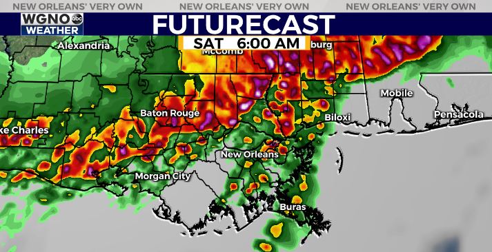
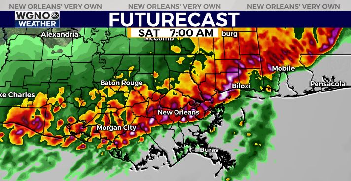
We continue to watch the development of a strong line of storms to the northwest as it begins to move closer to southeast Louisiana and southern Mississippi. Scattered storms have also been developing out ahead of the line through the early morning hours.
Any storm that can intensify enough ahead of the main line will have a tornado and hail threat with it. The best chance of that looks to be along and north of I-12. A tornado watch is in effect for the northern half of the area until 7 AM.

After that the main line of storms begins to move in around sunrise as it pushes southeast. This will be the main threat of strong winds through the morning.

It looks like a slightly higher chance of damaging winds on the eastern side of the area, east of New Orleans and in southern Mississippi. However everybody will have the chance to see strong wind gusts as the line moves through.
The good news is it will continue to move south and offshore by late morning. Locally heavy rainfall amounts can be expected however as the line moves through.
Stay with WGNO on air and online for the latest, and download our WGNO news app.


