11:30AM VIDEO FORECAST — Potential tornado in New Orleans overnight. Few downpours into the evening. Drier days ahead! Here’s the detials:
Potential Tornado touchdown overnight from Uptown, New Orleans to Algiers Point with a broken path of damage over 3 miles. Power lines & trees snapped.
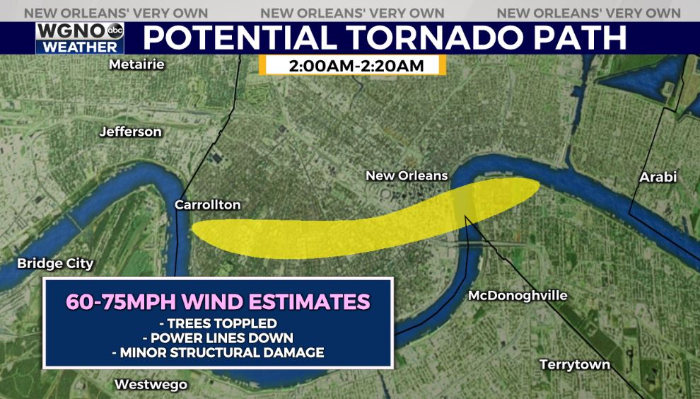
Numerous reports of trees down near Claiborne, Spruce, Pine Streets Uptown.

Shortly after 2AM, over 10,000 residents were without power from Uptown to the CBD to Algiers Point from a possible tornado touchdown.
Thankfully, the worst of the weather has moved on! Light showers around this morning with scattered hit/miss showers through the day.
Late this afternoon/evening, with daytime heating, we may see additional thunderstorm development. Greatest rain coverage on the Southshore. Not a washout, but a few scattered storms possible.

Tomorrow, cooler & drier air will settle in! Lovely weather into the weekend.