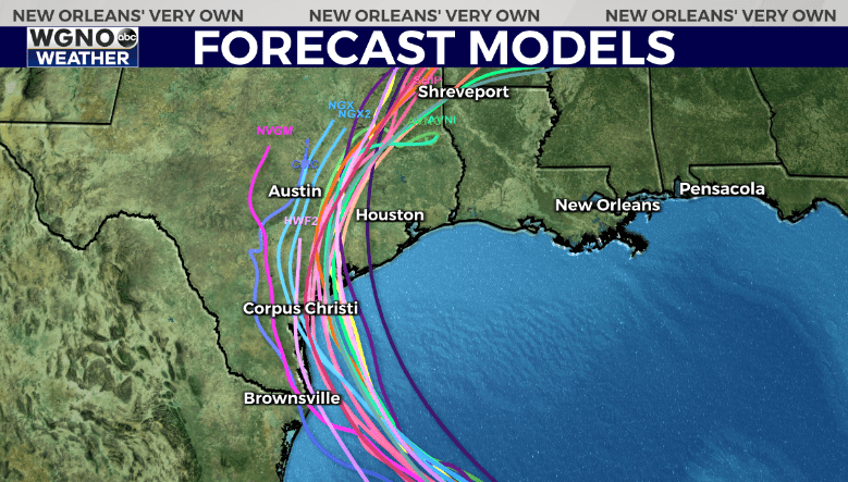
NEW ORLEANS (WGNO) — Tropical Storm Beryl is off the Yucatan Peninsula Friday evening with winds of 60 mph. The storm has become disorganized and will likely take time to get to the point where it can begin strengthening again. The forecast track has been shifted to the east and northeast by the NHC to fall more in line with various forecast models.

This track could shift even further east over the next day or so if models become more consistent on a landfall point closer to Houston. At the moment the Matagorda Bay area is a good starting point to estimate where landfall could occur. It’s important to note the wide cone towards the end of the forecast which indicates the uncertainty that still exists with the forecast track.
The official forecast from NHC has the storm as a category 1 at landfall. However it’s possible we could see this strengthen more. Conditions will become more favorable the last 18-24 hours before landfall which could lead to intensification at that point. It will depend on how well structured the storm is as it moves through the western Gulf.

The European is just one model, but shows how the storm will likely be getting stronger as it approaches the coast.
Locally our impacts still look minimal. As the storm moves inland and begins to turn east it will likely draw up additional moisture from the south. We could see a day or two of rain bands over the area with a localized flash flood threat. That would likely be around the Tuesday/Wednesday time frame. Stay tuned for details on that potential.
Beyond this the rest of the tropics are looking relatively quiet as we head into the middle of the month.
Stay prepared this hurricane season with our WGNO News Special Hurricane Season 2024: Your Questions Answered.
Hurricane Season 2024: Your questions answered in this WGNO special report | WGNO.com
Stay up to date with the latest news, weather and sports by downloading the WGNO app on the Apple or Google Play stores and by subscribing to the WGNO newsletter.


