NEW ORLEANS (WGNO) — Hurricane Beryl continues to be a category 2 storm with winds of 110 mph as it moves quickly west-northwest at 20mph. Only slight strengthening is forecast before it makes landfall along the eastern coast of the Yucatan Peninsula.
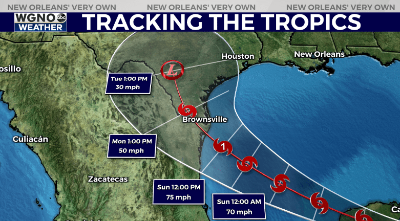
The latest forecast track is basically unchanged. This system will continue west and weaken as it moves over land. It will then re-emerge in the southern Gulf over the weekend. The latest forecast track from the NHC is mostly unchanged.

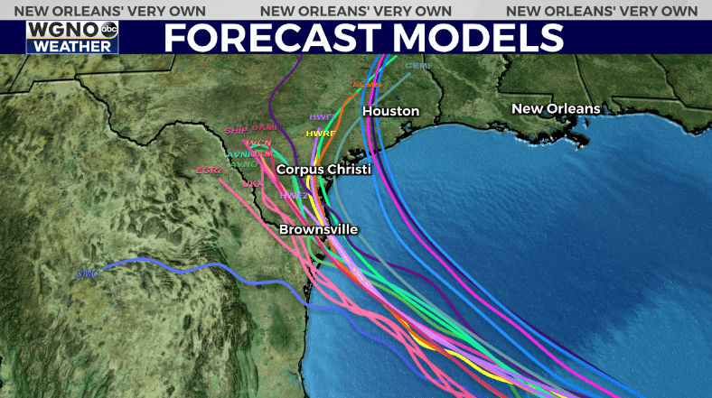
Forecast models have also come in to more agreement on a turn to the north in the western Gulf. This will bring the storm to either northern Mexico or southern Texas by early Monday. There is the chance of it briefly strengthening back to a hurricane before making landfall.

Beyond this the rest of the tropics are looking relatively quiet as we head into the middle of the month.
Stay prepared this hurricane season with our WGNO News Special Hurricane Season 2024: Your Questions Answered.
Hurricane Season 2024: Your questions answered in this WGNO special report | WGNO.com
Stay up to date with the latest news, weather and sports by downloading the WGNO app on the Apple or Google Play stores and by subscribing to the WGNO newsletter.


