NEW ORLEANS (WGNO) — Tropical Storm Beryl is showing signs of reorganization after weakening while over land in Mexico’s Yucatan Peninsula.
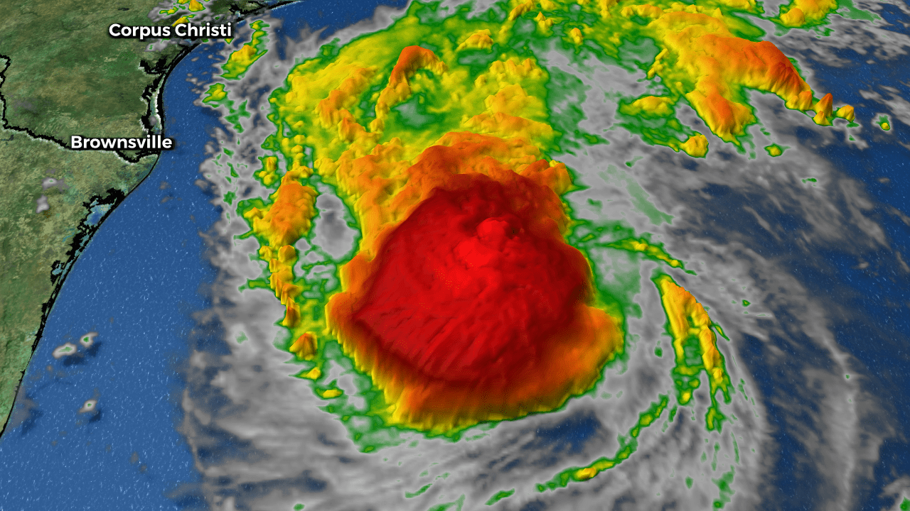
The storm has formed a ragged band of storms in its western half, although the strongest part of the storm seems to be forming around a mid-level center rather than the surface center. Recent data from Hurricane Hunter aircraft indicate that Beryl has maximum winds of about 60 mph.

Path and Predictions
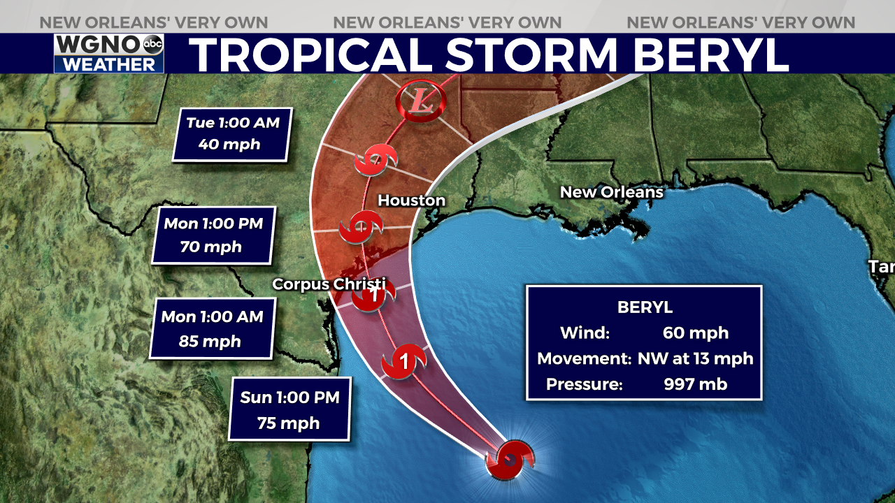
Beryl is moving northwest at 13 mph, guided by a developing mid-latitude trough over the central United States, which is creating a break in the subtropical ridge of high pressure over Texas.

This pattern is expected to steer Beryl toward the Texas coast, with landfall projected to occur between 36-48 hours from now, likely by the middle of the day Monday. After making landfall, Beryl is expected to turn northeast.
While there has been a slight northward shift in Beryl’s track, the storm’s forecasted landfall location has changed only slightly, and the timing has moved up by a few hours. Some erratic motion could occur tonight due to possible reformation of the storm’s center.

Intensity and Warnings
Currently, Beryl is battling wind shear and dry air, which has limited its organization. However, the shear is expected to decrease by Sunday morning, allowing Beryl to strengthen.
The latest forecast from the National Hurricane Center predicts that Beryl will regain hurricane status by Sunday or Sunday night, reaching winds of about 85 mph as it approaches the Texas coast. After landfall, the storm is expected to weaken rapidly, degrading to a remnant low-pressure area within a few days.

Potential Impacts
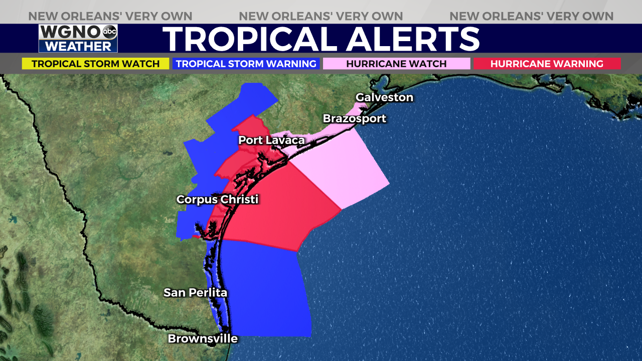
- Storm Surge: There is a significant danger of life-threatening storm surge inundation late Sunday night and Monday along the Texas coast from the north entrance to Padre Island National Seashore to San Luis Pass. Residents in these areas should heed local officials’ advice and follow any evacuation orders.
- Hurricane Conditions: Beryl is forecast to bring damaging hurricane-force winds to parts of the lower and middle Texas coast late Sunday night and Monday. A Hurricane Warning is now in place from Baffin Bay to Sargent. Residents should complete their preparations before tropical storm conditions begin late Sunday.
- Flooding: Flash and urban flooding, which may be locally significant, is likely across portions of the Texas Gulf Coast and eastern Texas from late Sunday through the middle of next week. River flooding is also possible in these areas.
- Rip Currents: Dangerous rip currents will continue to cause life-threatening beach conditions throughout the weekend across much of the Gulf Coast. Beachgoers should heed warning flags and follow the advice of lifeguards and local officials before entering the water.
Preparation and Safety
Residents in the path of Hurricane Beryl should take all necessary precautions to protect themselves and their property. Stay informed through local news and weather updates, and follow any evacuation orders or safety advice from local authorities.
The average forecast error for Beryl’s track at 36 hours is about 50-60 miles, and the average intensity error is close to one category, so it is crucial to remain vigilant and prepared as the situation evolves.
Stay up to date with the latest news, weather and sports by downloading the WGNO app on the Apple or Google Play stores and by subscribing to the WGNO newsletter.


