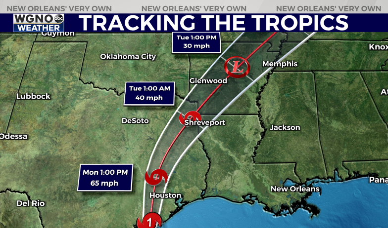
NEW ORLEANS (WGNO) — Hurricane Beryl made landfall around 4 AM Monday morning as a category 1 storm with winds around 80 mph. Heavy rain and storm surge is impacting the Texas coast as the storm heads towards the Houston area.

This system will be moving very quickly to the north through the week. This puts the storm in Arkansas by Tuesday afternoon.
Biggest inland impacts will be the threat of locally heavy rain and isolated tornadoes. As usual the eastern side of the storm will have a relatively high risk of tropical tornadoes.
Locally we will see wind out of the south over the next couple of days as Beryl moves north. This could lead to high water and minor coastal flooding along any south facing coastal areas.
Travel delays are also likely around Houston this morning so if you are flying out be sure to check ahead with the airline.
Stay up to date with the latest news, weather and sports by downloading the WGNO app on the Apple or Google Play stores and by subscribing to the WGNO newsletter.


