NEW ORLEANS (WGNO) — Hurricane Beryl has lost just a little strength Tuesday morning with the winds still at 160 mph and the pressure up to 938 mb. This system will likely bring extremely dangerous and significant storm surge to the island of Jamaica.
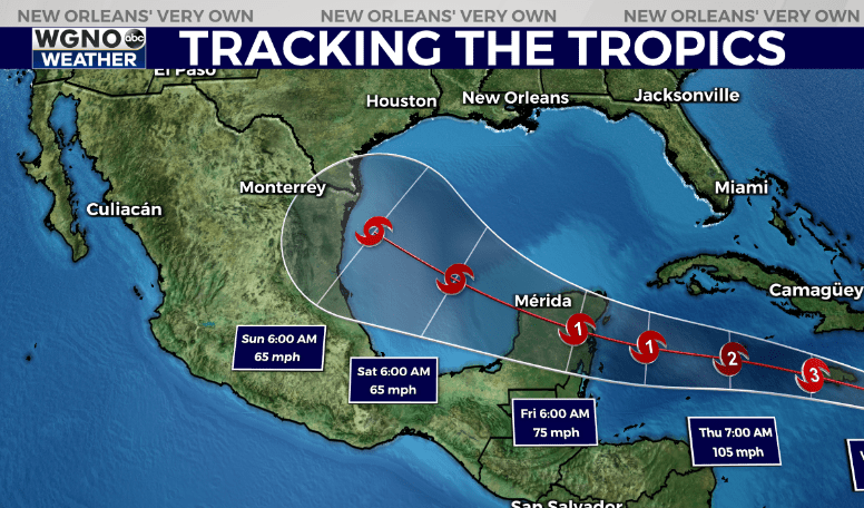
The latest forecast track continues to take the storm to the Yucatan Peninsula but does shift it more north after that and also indicates a large potential track with a larger cone.

The storm is still forecast to weaken quite a bit over the next few days, and that will play a role on the track as well. A stronger storm would likely respond more to the ridge and stay north, while a weaker storm will tend to drift west. It’s possible though the storm stays stronger than the current forecast.

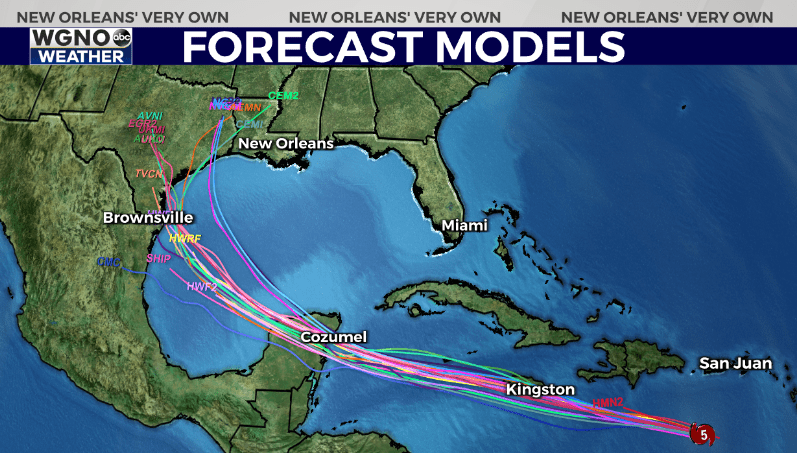
Forecast models are coming more in line with a track that turns north after Mexico. This could mean bigger impacts for the western Gulf. Right now this is still not a storm expected to make it to southeast Louisiana, but it does have a chance to move closer to us than it looks the past couple of days. The theme is this is still well down to the south and the margin of error this far from landfall is high. Continue to monitor this and be prepared.
Stay up to date with the latest news, weather and sports by downloading the WGNO app on the Apple or Google Play stores and by subscribing to the WGNO newsletter.


