NEW ORLEANS (WGNO) — Hurricane Beryl remains a Category 4 w/ 130mph winds. The system is looking more ragged on satellite, and it may be starting to weaken more sizably under the presence of wind shear.
Hurricane conditions possible in Grand Cayman as the storm slides south of the island followed by more significant impacts possible the Yucatan of Mexico Thursday night-Friday.

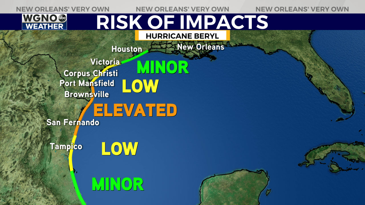
Interests in the northwest Gulf Coast should remain vigilant & watch the forecast carefully, particularly in south Texas to northern Mexico.
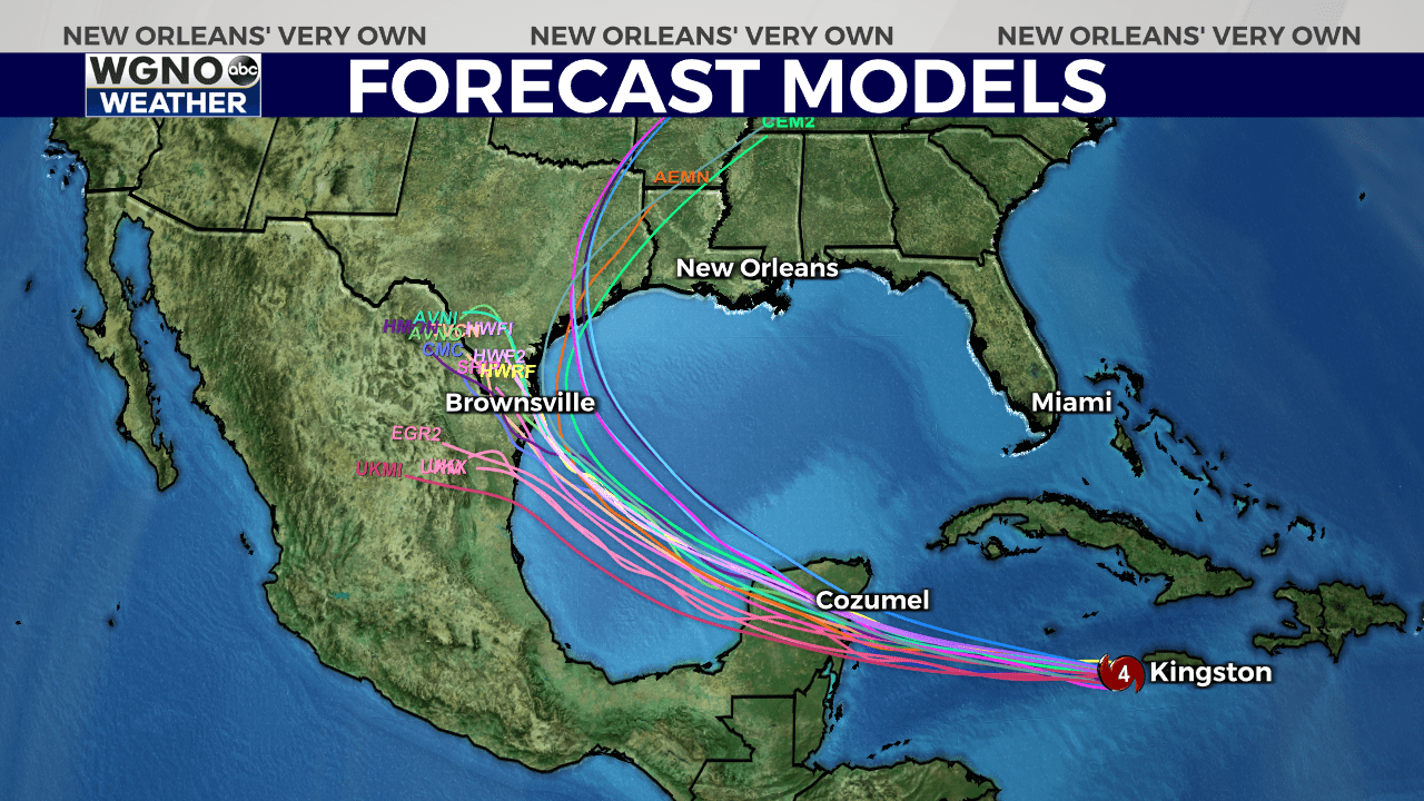
Beyond Friday, there remains quite a spread in intensity & projected path & intensity.

From the National Hurricane Center “the spread in the models increase by the time Beryl nears eastern Mexico and southern Texas and accordingly, confidence in the details of the track forecast are low at long range.”
Remember, rain & coastal impacts will extend hundreds of miles from where center comes onshore.

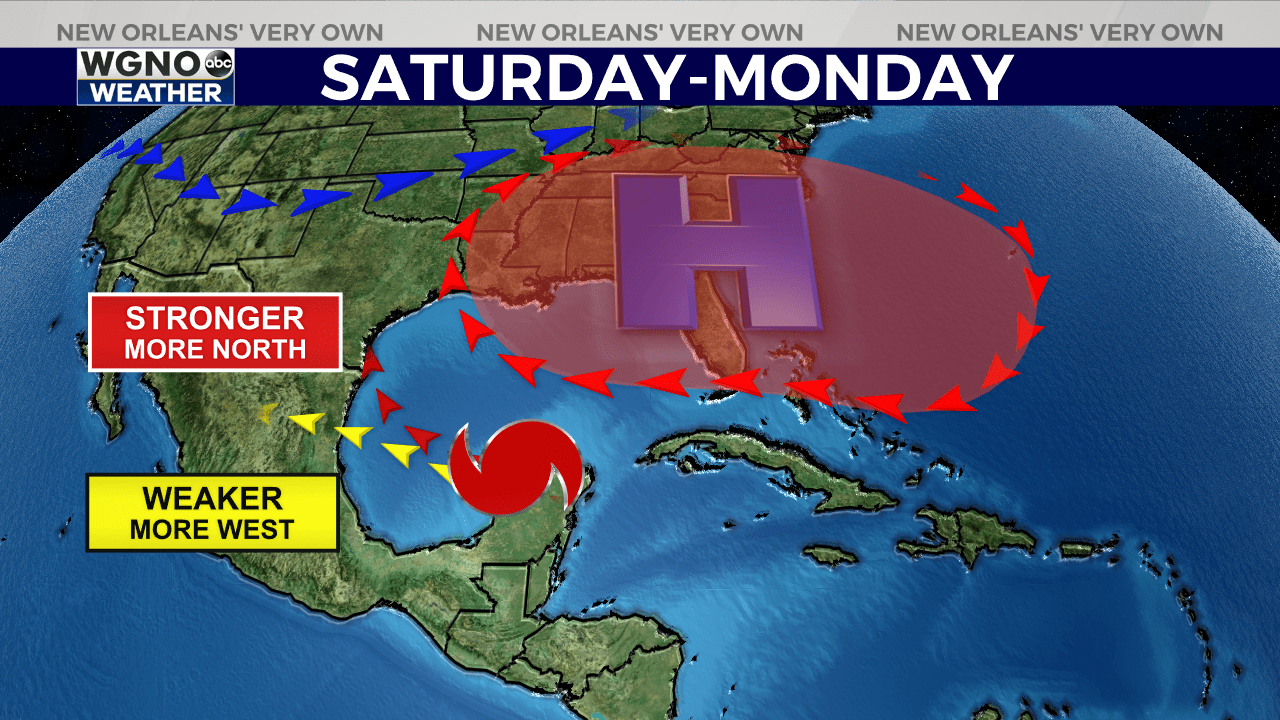
This ridge of high pressure looks to hold on long enough to act as a shield of protection for the east-central Gulf Coast. The concern level is *very low* at this point from Louisiana-Florida at this time.
If you’re watching from southeast Texas, concern is *low*, but we’re still monitoring for forecast changes.

From south Texas to northern Mexico, forecast is growing more likely for hurricane impacts Sunday-Monday. Model guidance is showing a more favorable environment for potential strengthening in the Gulf of Mexico. Always prepare for category above the forecast(currently Cat 1 projected near landfall just south of Brownsville.)
A stronger Beryl after crossing the Yucatan could be tugged more northwest towards Texas. A weaker Beryl would likely be steered more west between Tampico, MX and Brownsville, TX. Highest likelihood for sizeable impacts looks to be in south/central Texas-northern Mexico.
As always, remain vigilant & prepared & stay tuned with updates.

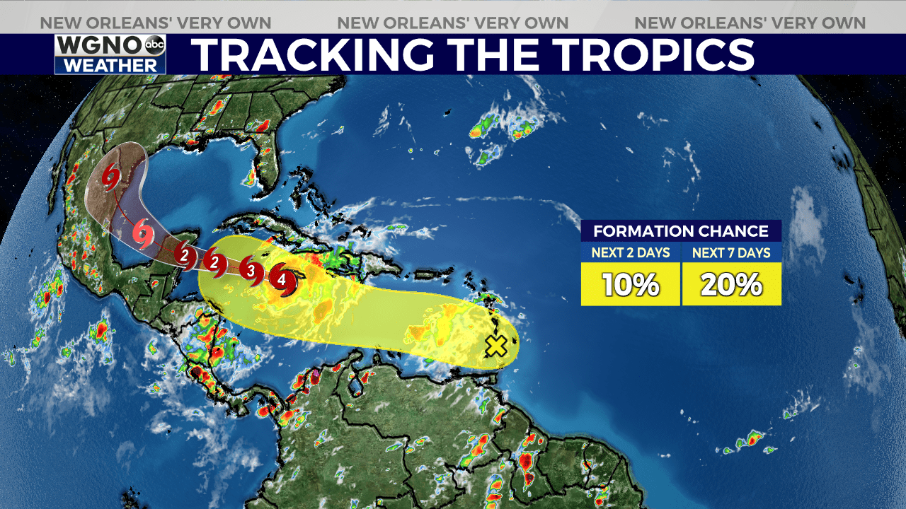
Behind #HurricaneBeryl, Invest 96L is showcasing a bit more convective life this morning after being squashed by Saharan Dust for the last few days. National Hurricane Center is presently giving a 20% chance of formation within the next 7 days.
This disturbance may find a more favorable environment in the western Caribbean/western Gulf. The key will be if it can maintain distance from Beryl, as wind shear from Beryl’s outflow may tear this disturbance apart. Something to watch.
Stay up to date with the latest news, weather and sports by downloading the WGNO app on the Apple or Google Play stores and by subscribing to the WGNO newsletter.


