NEW ORLEANS (WGNO) — Hurricane Beryl continues to move across the Caribbean Sea towards Jamaica, where life-threatening conditions are expected to begin within hours. Although the storm has weakened slightly, it remains a formidable threat.
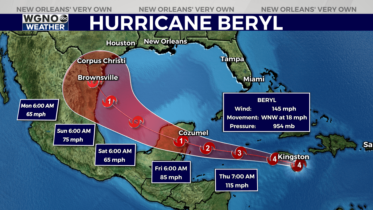
Recent reports Hurricane Hunter aircraft show that Beryl’s central pressure has risen to 954 mb. Winds measured by the aircraft suggest the hurricane still packs a punch, with sustained winds of about 145 mph. However, westerly shear is impacting the storm, causing its eye to disappear from satellite images and the cloud pattern to become ragged.
Beryl is currently moving at 18 mph, steered by a high-pressure ridge over the southeastern United States. This trajectory will bring Beryl near or just south of Jamaica within the next 6 to 12 hours and south of the Cayman Islands by tonight. The hurricane is expected to reach the Yucatan Peninsula in 36 to 48 hours and move into the southwestern Gulf of Mexico by 60 hours from now.

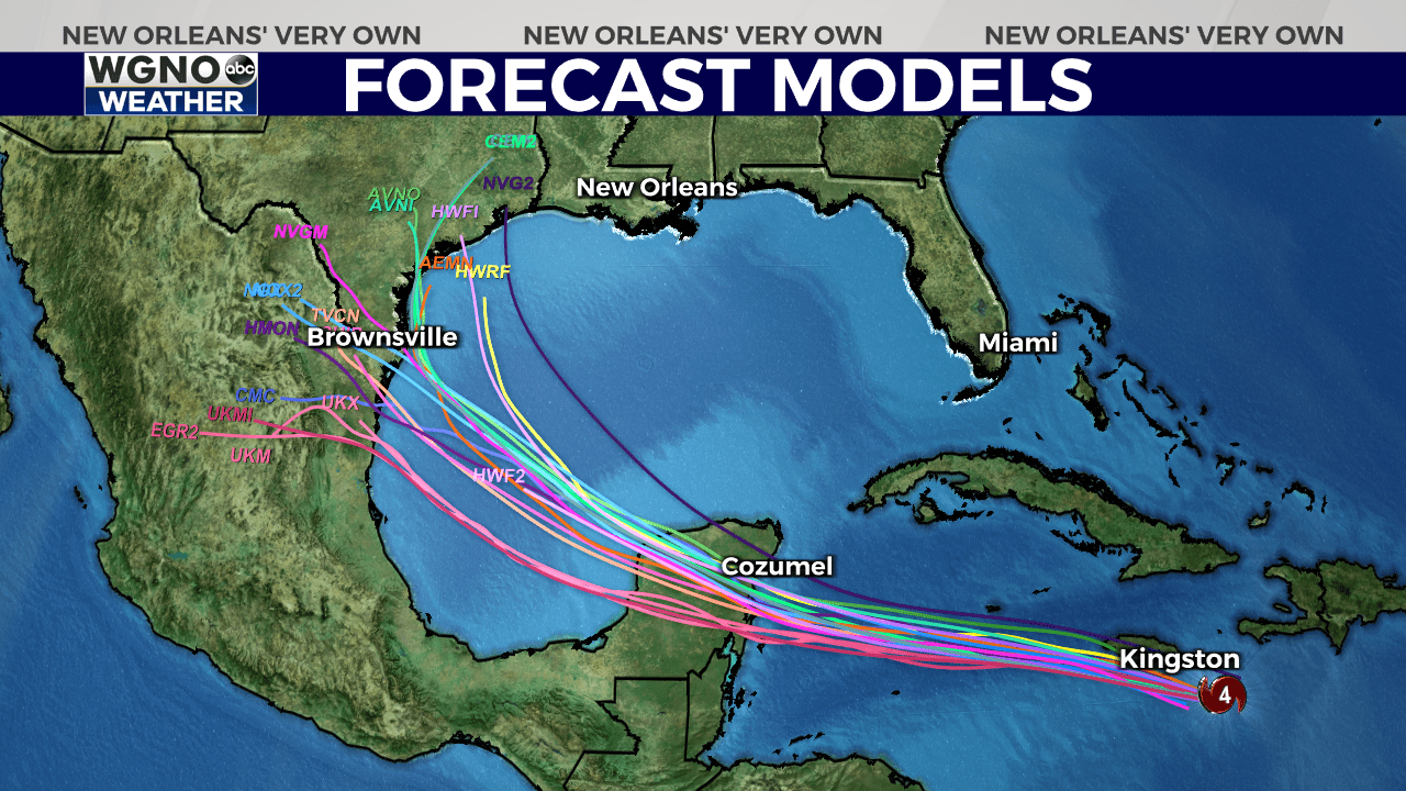
There is uncertainty about Beryl’s exact path once it enters the Gulf of Mexico. Some models predict a northerly turn toward the Texas coast, while others suggest a more westerly route towards Mexico. The forecast track lies in the middle of these predictions.

The storm is expected to encounter more wind shear, leading to steady weakening. Despite this, Beryl is forecast to remain a hurricane as it approaches the Yucatan Peninsula, where it will likely weaken further before re-intensifying over the Gulf of Mexico. Beryl is predicted to regain hurricane strength before reaching the western Gulf coast, followed by weakening after landfall.
Stay up to date with the latest news, weather and sports by downloading the WGNO app on the Apple or Google Play stores and by subscribing to the WGNO newsletter.


