NEW ORLEANS (WGNO) — The National Hurricane Center is highlighting two areas of potential tropical development over the next 7 days. The closest is in the southern Gulf where Alberto formed earlier this season. That has a 30% chance over 7 days. Anything that develops would be staying in the southwestern Gulf as the past couple of waves there have.
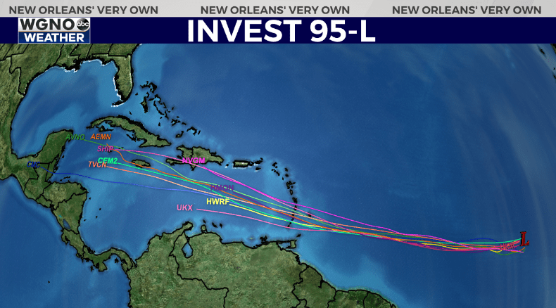
The main feature we are watching is currently labeled as Invest 95L. This a system still well out in the Atlantic southwest of the Cape Verde islands. Right now it has a 90% development chance through 7 days from the NHC.
It’s possible this could become our next named storm, and maybe even the first hurricane of the season. It will be fighting the Saharan Dust Layer which could inhibit development, although most models do indicate strengthening.

It is obviously very early and this system is still well to the east, but most models to agree on this moving west into the central Caribbean. At that point all options are still on the table for a move into Mexico or more into the Gulf.
This is not a concern for us at the moment, and very few system that originate in that area impact southeast Louisiana. However it is also something that we will keep a close eye on over the next week as it moves west.
As always be prepared now as we head toward the peak of hurricane season. Don’t wait until a storm is in the Gulf to get supplies or have a plan.
Stay up to date with the latest news, weather and sports by downloading the WGNO app on the Apple or Google Play stores and by subscribing to the WGNO newsletter.


