NEW ORLEANS (WGNO) — Hurricane Beryl, now a powerful Category 4 storm, continues to marching west toward the Caribbean. Meanwhile, warnings are being issued for portions of Mexico as a new tropical storm develops in the Gulf.
Hurricane Beryl Approaches Windward Islands
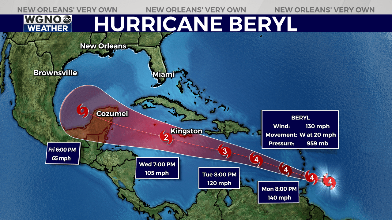
After rapidly intensifying over the past two days, Beryl’s strength has plateaued, maintaining wind speeds of up to 130 mph. The hurricane now has a well-defined circular eye, although recent observations indicate some weakening on its southern side. Despite this, Beryl remains an extremely dangerous storm.

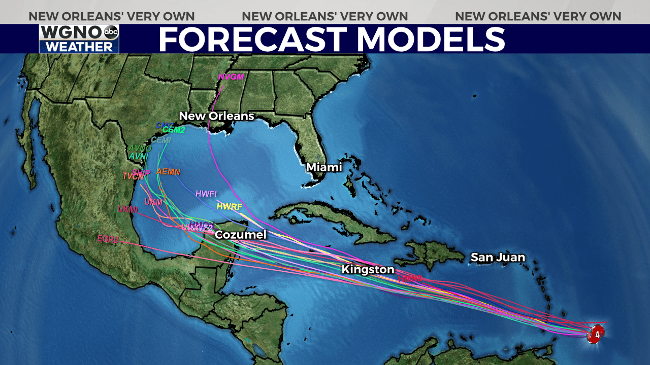
Currently, Beryl is moving quickly westward at 20 mph, steered by a strong ridge of high pressure to its north. This movement is expected to continue, with the storm’s trajectory shifting slightly to the northwest over the next few days. The hurricane is forecasted to maintain its extreme intensity as it approaches the Windward Islands, bringing potentially catastrophic conditions.
The National Hurricane Center (NHC) warns that Beryl will likely bring hurricane-force winds, life-threatening storm surges, and damaging waves to the Windward Islands. The islands of St. Vincent and the Grenadines, as well as Grenada, are expected to be hit hardest early Monday morning.

As Beryl moves past the Windward Islands, the storm is expected to remain a significant hurricane despite a gradual weakening trend due to increasing wind shear. However, the NHC emphasizes that Beryl will still pose a substantial threat as it progresses westward.
Tropical Storm Chris Forms in Gulf of Mexico
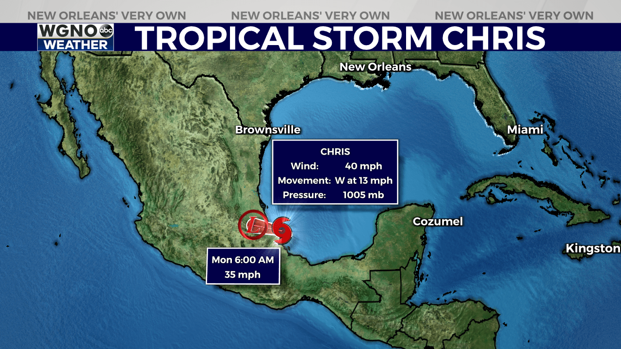
The NHC announced late Sunday that the third tropical cyclone of the 2024 Atlantic hurricane season had formed. It has since strengthened into Tropical Storm Chris and is forecast to make landfall in Mexico overnight.
Satellite images show developing curved bands of clouds in the northwest and northeast areas of the system, with a recent burst of deep thunderstorms near its center. Current wind speeds are estimated to be around 40 mph.

Another Atlantic Storm May Soon Develop
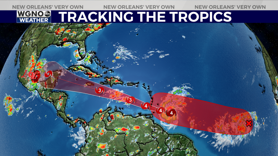
The NHC also continues to monitor a disturbance in the central Atlantic with a high chance of developing into a tropical depression or tropical storm.

Conditions are favorable for this system to develop further, and it is likely to become a tropical depression by midweek. The system is moving westward at 15 to 20 mph across the eastern and central tropical Atlantic.
The NHC says residents in the Lesser Antilles should keep an eye on this developing weather system for potential impacts.
Stay up to date with the latest news, weather and sports by downloading the WGNO app on the Apple or Google Play stores and by subscribing to the WGNO newsletter.


