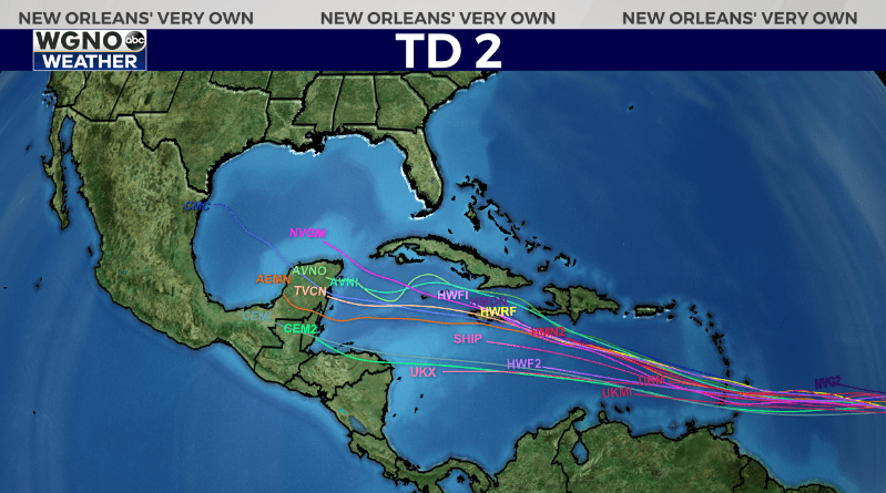
NEW ORLEANS (WGNO) — The strong tropical wave in the Atlantic we have been watching the past couple of days is now Tropical Depression 2 as of Friday afternoon. This system looks very impressive on satellite and will likely strengthen to a named storm by tonight or Saturday. The next name on the list is Beryl.
It is somewhat unusual to get a named storm that far out in the Atlantic this time of year, and these storms usually do not intensify as they would later in the season. However all indications are this will become our first hurricane of the season and could even get close to major storm status.

The forecast models are in good agreement of the path over the next few days. This system will continue west through the Atlantic and eventually move into the central Caribbean. Beyond that there is a lot of uncertainty since it will be more than a week out.
We will be watching this closely through the holiday week. While not a threat to the northern Gulf at the moment, there are still many potential areas that could be impacted after the 4th. It’s important to be prepared now in case a storm comes our way this hurricane season.
As always stay with WGNO on air and online for the latest.
Stay up to date with the latest news, weather and sports by downloading the WGNO app on the Apple or Google Play stores and by subscribing to the WGNO newsletter.


