It was another gorgeous day today across southeast Louisiana and New Orleans proper after Sunday’s trough cleared our area, ending showers!
Earlier, forecasts verified since we were anticipating a windy, chilling start with 40 degree temperatures beyond Lake Pontchartrain.
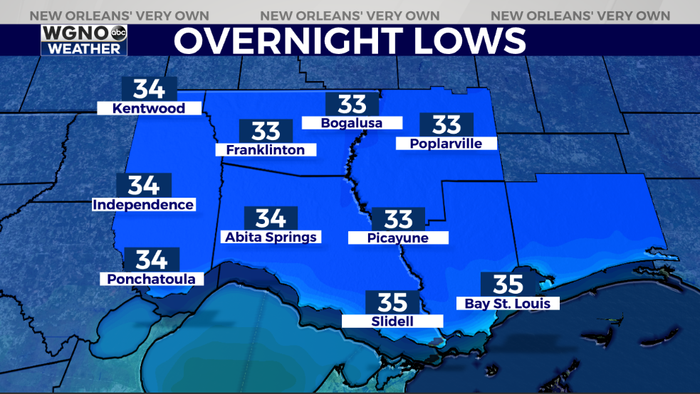
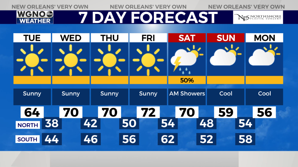
Tuesday, lows drop even more to be below 34 degrees. Brace yourself: I am talking coldest weather throughout your region on maps all week! Highs by everyone’s afternoon after lunch should reach just below 60!
Frost remains possible across Northshore locations, so remember all 3 Ps: people, pets, as well as plants! Fortunately, for these next 48 hours, pipes won’t face any problems!
Keep up, updates stay available during Good Morning New Orleans plus online!
Check out current conditions near you: https://digital-staging.wgno.com/weather/new-orleans-weather-radar/
Stay up to date with the latest forecast: digital-staging.wgno.com/weather/forecast/
Download the WGNO Weather App to stay connected this hurricane season