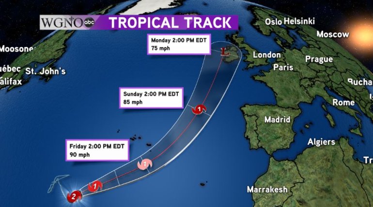
NEW ORLEANS — Hurricane Ophelia continued to strengthen this afternoon and reached Category 2 status as maximum sustained winds are 100 mph as of the 4 p.m. advisory Thursday.
Ophelia is currently stationary in the Northeastern Atlantic but is expected to get picked up by a trough and cause it to start moving off to the east-northeast by Friday morning. While most of the track remains over water, Ophelia looks to make an impact on Ireland by Monday afternoon (Central time).

Due to the evolving nature of the system, it won’t actually hit the Emerald Isle as a hurricane even though maximum sustained winds will be around 75 mph. The reason is by late Sunday into early Monday, Ophelia will be absorbed into the trough and lose its tropical characteristics.
That doesn’t mean any less of an impact for Ireland though. Superstorm Sandy was a hurricane that lost its tropical characteristics shortly before landfall and still caused massive amounts of damage along the Mid-Atlantic coast.
Only time will tell if the storm directly strikes Ireland or misses it slightly as some models suggest. Either way, while this isn’t a rare occurrence, it certainly is unusual.


