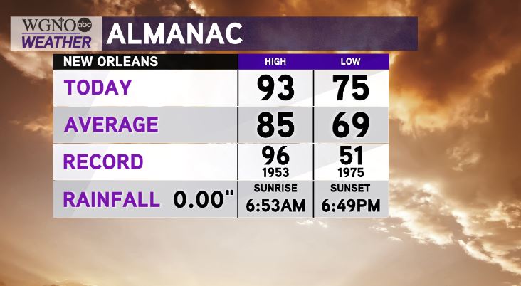
Talk about a Tale of Two Seasons! Earlier today, high temperatures across New Orleans reached 93 degrees before our much anticipated first “real” cold front rolled through during your afternoon on radar!

Few storms accompanied the boundary, even with some hail, but, winds across our area are still gusting near fifteen miles per hour.
Overnight, over Northshore locations’ temperatures will drop considerably as residents wake up to 50s while Southshore residents wake up to 60s.

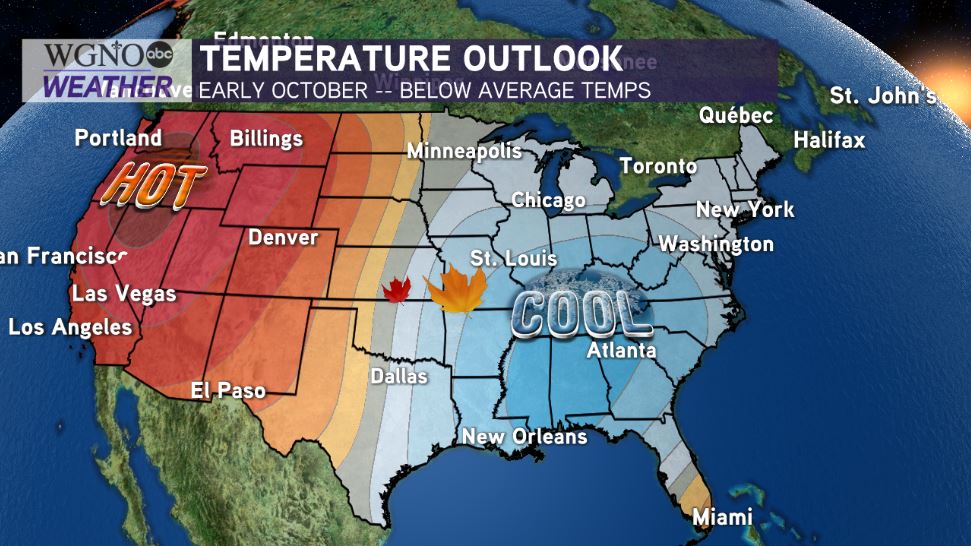
Dry air will be behind this air mass, sticking around for foreseeable days ahead! Climate Prediction Center outlooks show conditions stay below average during October’s start!
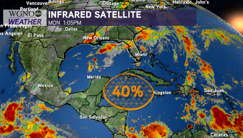
Remember, Hurricane Season 2020 does not end until November 30th. We are closely watching one disturbance for formation potential near the western Caribbean Sea.
Right now, this is no immanent concern here locally but worth keeping an eye on based off of its medium development potential!

National Hurricane Center meteorologists give about a 40 percent chance of development over these next five days but near zero chance of development over these next two days.
If anything, an unorganized, broad low pressure area may be beginning to form by late week. We’ll, of course, watch its behavior to see if movement near the Gulf of Mexico looks likely.
Enjoy indulging in sweater weather! We have a 100% chance of Meteorologist Scot Pilie issuing his Gumbo Warnings soon! ‘Tis the season!


