NEW ORLEANS — High-res model guidance highlighting scattered rain chances into the evening southeast Louisiana & south Mississippi.
Another round of off & on storms tomorrow. Rain chances highest along the coast in the morning, working their way northward by mid day-early afternoon.
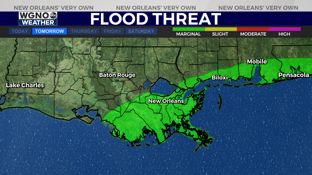
It won’t rain all day, but I’d expect to dodge storms. Weather Prediction Center has placed a Marginal Risk(Level 1 out of 4) for excessive rainfall & flash flooding. Watch for storms to produce quick 1-2″ of rainfall.
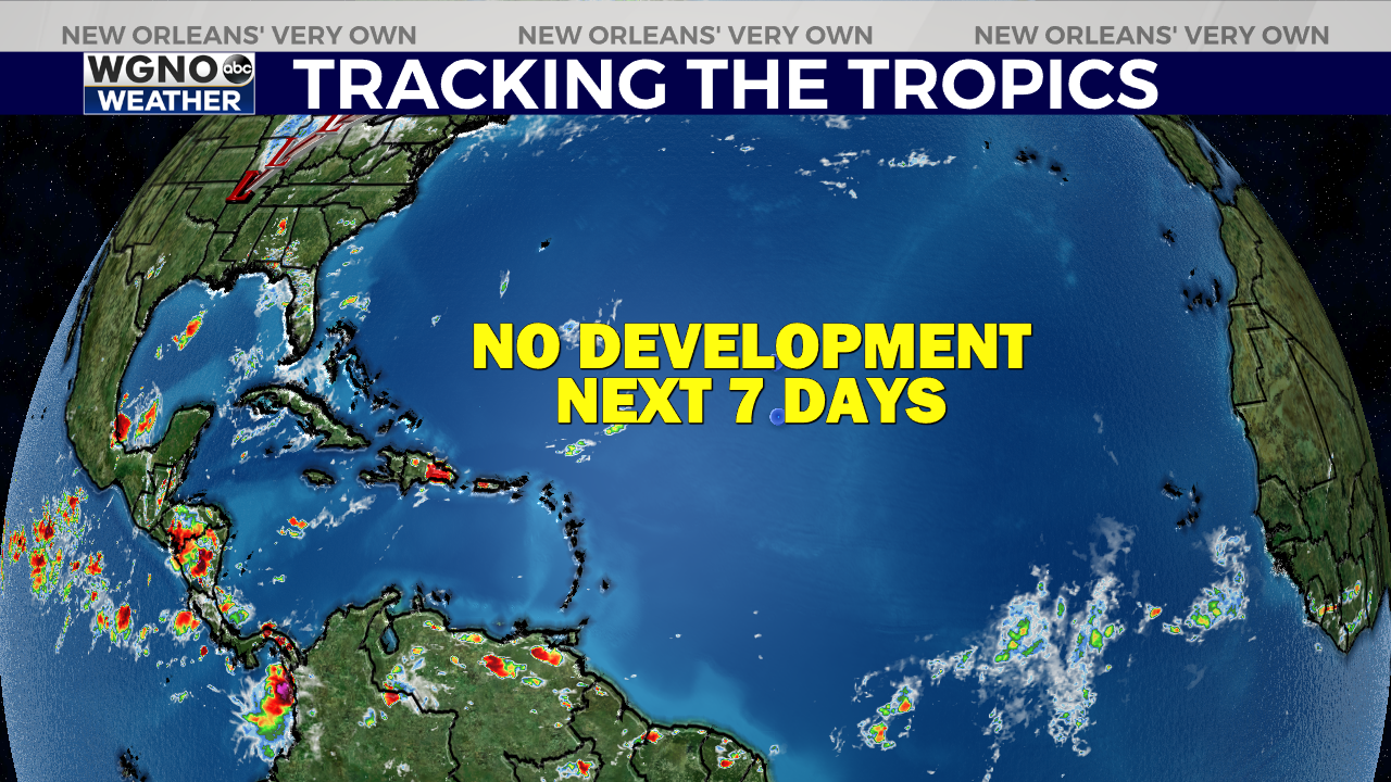
TRACKING THE TROPICS — Shhhhh![]()
![]()
No development expected in the next 7-10 days across the Atlantic Basin.
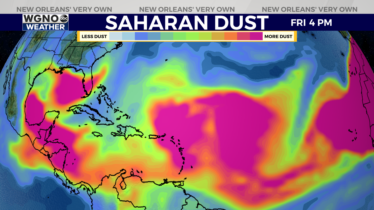
Large plumes of Saharan Dust will continue to roll off the Sahara Desert, which will hinder any development in the East Atlantic.
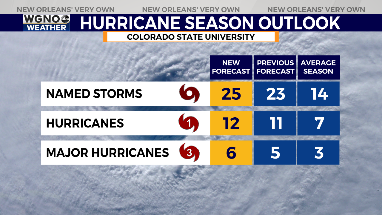
Don’t let this upcoming break fool you, Colorado State University updated their seasonal forecast today… and continue to call for an extremely active season.
The latest forecast: 25 Named Storms, 12 Hurricanes, and 6 Major Hurricanes. The average is 14 Named Storms, 7 Hurricanes & 3 Major Hurricanes.
Let’s enjoy the lull, we deserve it.