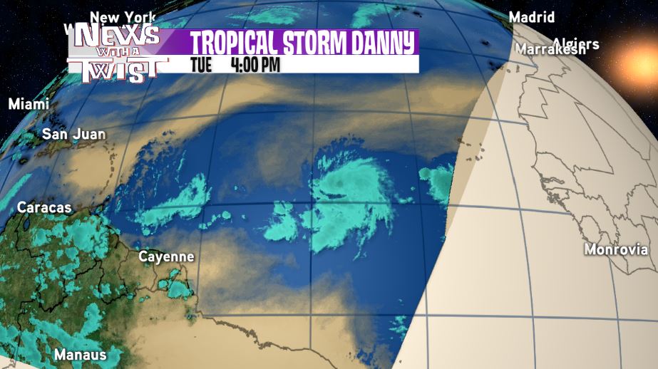
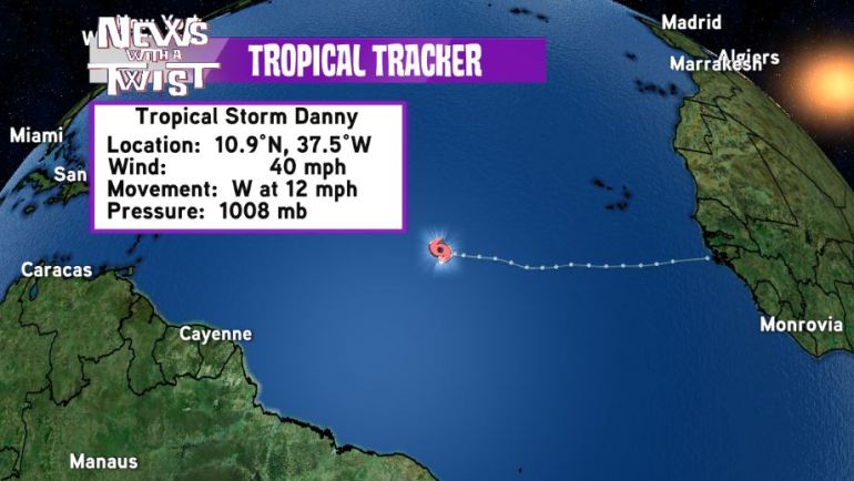
Way out in the middle of the Atlantic, tropical depression 4 strengthened into Tropical Storm Danny this afternoon. Currently, maximum sustained winds are 40 mph and Danny is moving to the west at 12 mph.
The National Hurricane Center is forecasting Danny to continue moving in a general westward motion over the next five days while continuing to strengthen. By Sunday afternoon, Danny should be approaching the Lesser Antilles as a Category 2 Hurricane. All interests in these islands should be monitoring the progress of Danny very carefully.
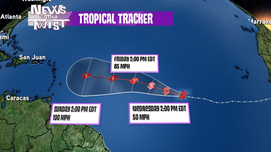
As for where Danny goes after this weekend, it is too early to tell. What we do know is that Danny has plenty of warm ocean water and moisture to work with so it will continue to strengthen for the next week or so. Models diverge greatly after the next five days so it is just too soon to tell where Danny will end up turning. You can depend on us here in the WGNO Weather Center to monitor the progress of Danny over the upcoming weeks and continue to provide updates and details on Danny’s path and forecast. (Jason Disharoon)