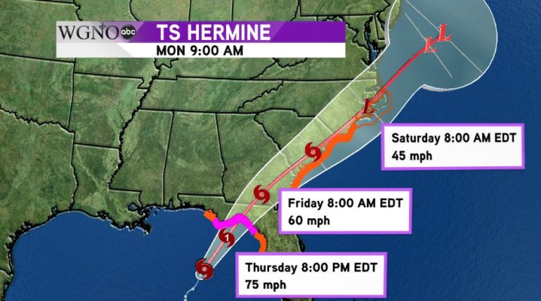
UPDATE: Tropical Storm Hermine has been upgraded. It’s now Hurricane Hermine, a Category 1 storm that’s still headed for the Florida Gulf Coast.
NEW ORLEANS (WGNO) – Tropical Storm Hermine has finally made that turn to the northeast that was expected and is speeding up as it approaches the Florida coastline.
As of 10 a.m., Hermine was packing sustained winds of 65 mph and could become a hurricane before making landfall along Florida’s Big Bend later tonight.

Because the forecast calls for Hermine to strengthen into a hurricane briefly before landfall, hurricane warnings are in effect for the Florida coastline from the mouth of the Suwanee River up to Mexico Beach. Tropical storm warnings extend out to the Anclote River north of the Tampa area to the Walton/Bay County line on the Florida panhandle.
Outside the threat of high winds, heavy rains with the potential for flooding and a storm surge up to six feet in some areas, mainly to the east of where landfall takes place, are the main concerns with this system as it bears down on the coast.
After landfall, Hermine is expected to continue northeast through Southern Georgia and along the Carolina coastlines through early Labor Day Weekend before turning out to sea and losing its tropical characteristics Sunday into Monday.


