![]() TROPICAL STORM #BETA
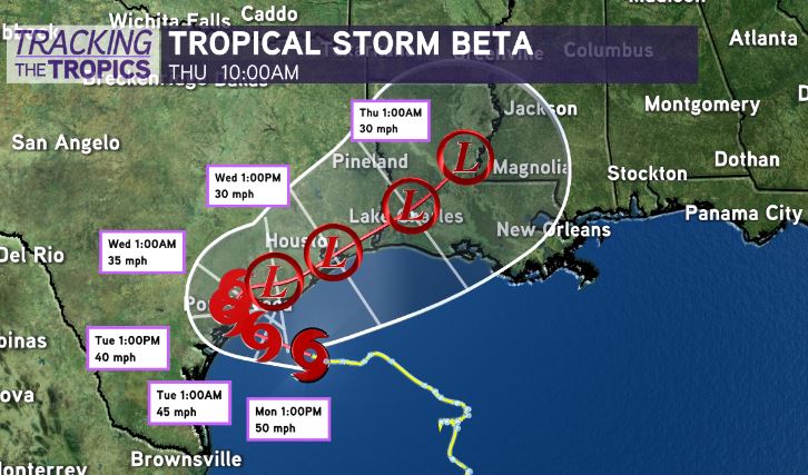
TROPICAL STORM #BETA![]() — Inching west at 6mph. Landfall expected tonight near Matagorda Island, Texas. Max winds at 50mph. Still battling dry air & wind shear, which will continue to hinder Beta from intensifying.
— Inching west at 6mph. Landfall expected tonight near Matagorda Island, Texas. Max winds at 50mph. Still battling dry air & wind shear, which will continue to hinder Beta from intensifying.

Even on this projected path towards Texas, heavy rainfall & flash flooding will be the primary threat in Louisiana. System is lopsided, with heavy rain extending WAY east of the center.

Increased coastal tides of 2-4 feet & intermittent periods of heavy rainfall likely across south Louisiana today through Thursday.

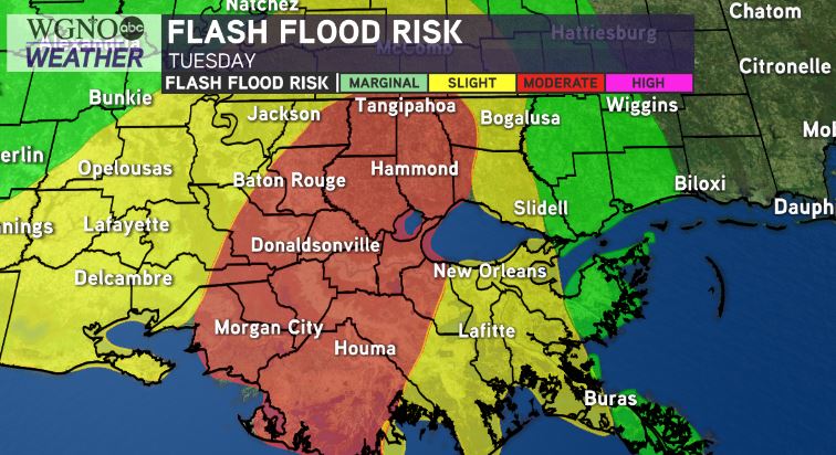
We will need to watch for heavy batches of rainfall “training” over Louisiana as the center of Beta heads towards south-central/East Texas. Especially Tuesday-Thursday. Weather Prediction Center has upgraded parts of Louisiana to a Moderate Risk(Level 3 out of 4) for heavy rainfall on Tuesday.

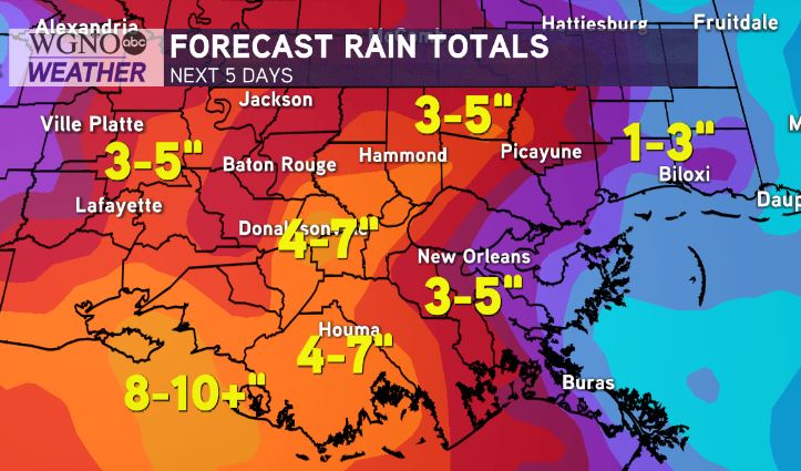
Greatest risk for localized heavy rainfall in coastal south Louisiana. 4-7” of rain appears likely through Thursday, with localized higher amounts.
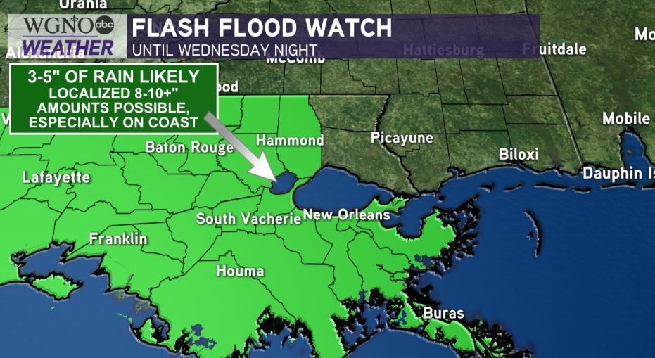
In metro New Orleans/I-10 corridor, gloomy with moderate rain expected & periods of heavier rain possible. 3-5” likely with localized higher amounts. Gusty winds of 35-45mph may accompany rain bands.
These amounts could potentially go up mid/late week…but this is highly dependent on where Beta’s heaviest rain bands set up. Where heaviest rain bands set up, localized hot spots of 8-10+” possible.
Stay tuned…


