10:00AM VIDEO FORECAST from Meteorologist Scot Pilie — Lovely Monday! Cool snap into Easter Weekend! Here’s the details:
Monday looks simply splendid with high temperatures in the lower to middle 70s under lots of sunshine!
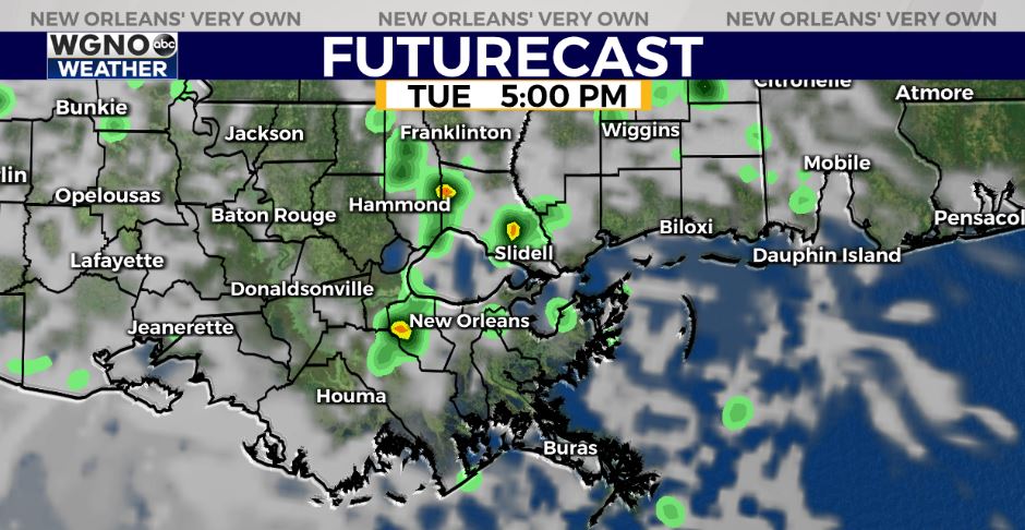
Tuesday, as a warm front lifts through the region, I’m expecting spotty/scattered t-storms possible. Rain chance/coverage at near 40%.
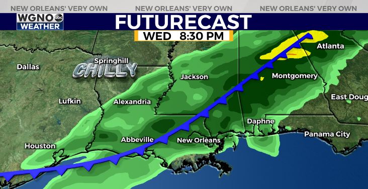
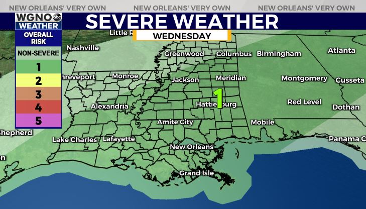
Best opportunity for rain arrives late Wednesday as a potent late season cold front rolls in! There is a Marginal Risk(Level 1 out of 5) for an isolated strong to severe storm.
Main risk of gusty winds. Rainfall amounts of .25-1.00″ expected.
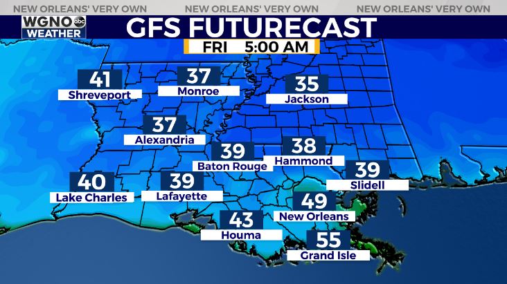
🥶LATE WEEK CHILL!🥶 — Cold weather fans, get excited! Strong cold front arrives late Wednesday bringing back dry, chilly temperatures Thursday-Sunday!

Highs only in the 60s Thursday-Friday with low temps in the 30s north of the Lake, 40s in Metro NOLA! Even better news? The forecast looks to stay quiet for Easter Weekend!


