10:00AM VIDEO FORECAST from Meteorologist Scot Pilie — Spotty rain Monday. Another severe threat Tuesday-early Wednesday. Here’s the details:
On Monday, a few spotty showers possible. Rain chance at near 40% coverage, with best rain opportunity on the Northshore.
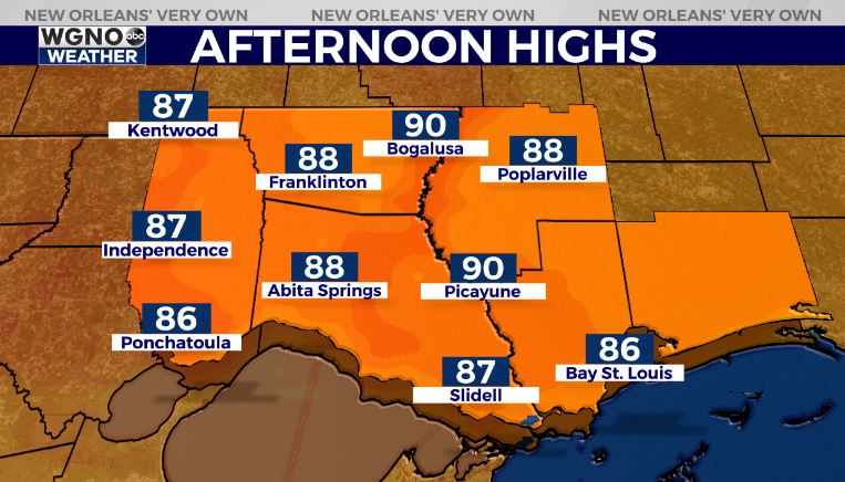
High temperatures in the upper 80s to near 90 on Monday-Tuesday.
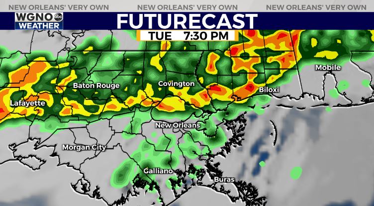
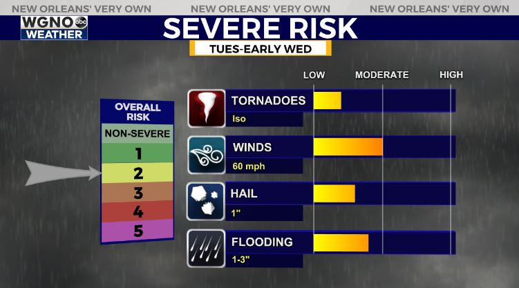
By late Tuesday-early Wednesday, rain chances will climb. Best ingredients for severe weather look to be north of I-12/I-10.
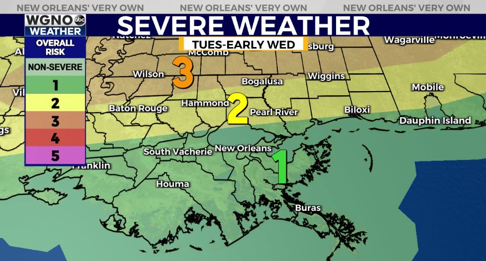
The Storm Prediction Center has far northern parts of the Northshore within an Enhanced Risk(Level 3 out of 5) to a Slight Risk(Level 2 out of 5) for severe thunderstorms. Main risk of damaging winds with an isolated tornado/large hail potential.
On the Southshore, there is a Margianl(Level 1 out of 5) for severe thunderstorms. Main risk of gusty winds, lightning, localized 1-3″ of rain.
By mid-late Wednesday, a late season cold front will push into the region!
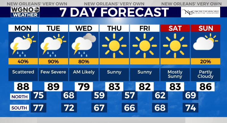
This front will help clear the warm, muggy, and stormy weather! A gorgeous late week and early weekend forecast!


