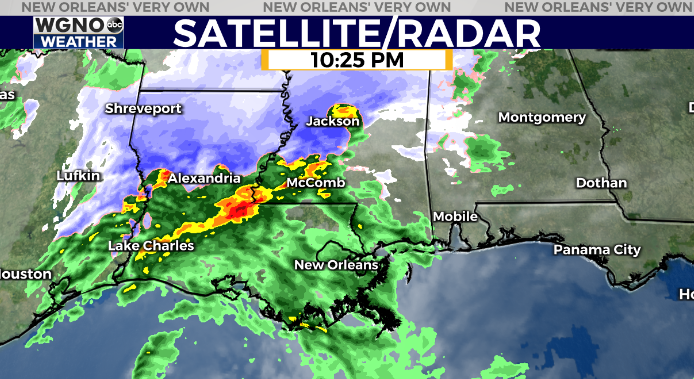
A strong storm system is bringing a rare blanket of snow to parts of Louisiana and Mississippi tonight but unfortunately for the snow lovers only rain for our viewing area.
Temperatures are just a bit too warm for us to get any of the white stuff. As a matter of fact that snow line is actually moving north a bit as expected this evening.
Rain chances will continue overnight with even a rumble of thunder possible on the south shore. Look for some locally heavy downpours as well.
Rain will be moving out around the morning commute time but the cold weather is here to stay for a couple of days. Monday will not be very pleasant with cloud cover, wind, and highs only in the mid 40s.
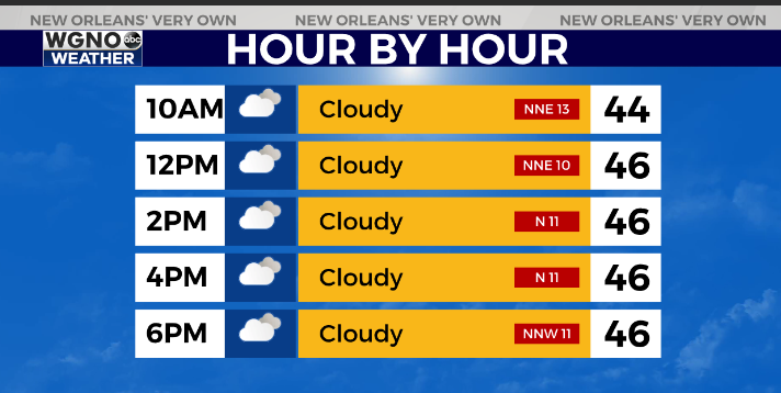
We get back below freezing on the north shore both Tuesday and Wednesday morning before starting to warm up a bit after that.
The rest of the week looks dry with temperatures back to the 60s on Thursday.
Check out current conditions near you: https://digital-staging.wgno.com/weather/new-orleans-weather-radar/
Stay up to date with the latest forecast: digital-staging.wgno.com/weather/forecast/
Download the WGNO Weather App to stay connected this hurricane season


