Big changes are on the way for the second half of the week after very pleasant conditions for the first few days. We are going to see one of the cooler stretches of afternoon temperatures in quite some time.
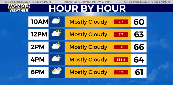
First off another mild day is on tap for Wednesday. However we will see more cloud cover through the day. Look for mid to upper 60s.

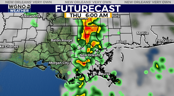
After that the first storm system of the week moves through the area overnight into Thursday morning. This will bring widespread rain with a few embedded thunderstorms. The timing of this looks to be early on Thursday.

Beyond that temperatures get much cooler. Upper 50s for highs on Thursday but most of the area may struggle to reach 50 by Friday afternoon. Overnight lows will also be back around freezing up to the north by Saturday morning.
Temperatures will stay chilly into early next week.


