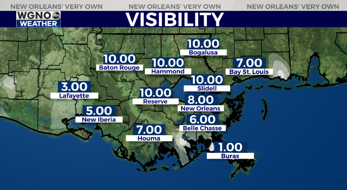
Sea fog is already developing down along the coastal areas and could spread inland by Thursday morning. Be prepared for some fog during the early commute especially on the south shore. Visibilities are already dropping along the coast and the river.

A Dense Fog Advisory is in effect for areas of Plaquemines parish but it’s possible this is expanded by tomorrow morning. We are looking at moisture moving back into the area which could lead to fog again Thursday night.

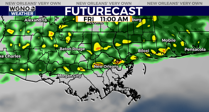
The main feature over the next few days will be a very slow moving front drifting south with rain along it. This will start to spread into areas near the MS border to the north by late Thursday, and then sink south through Friday.

Right now overall rain amounts look lite, but as this continues to sink south expect a much cooler day on Saturday.
Check out current conditions near you: https://digital-staging.wgno.com/weather/new-orleans-weather-radar/
Stay up to date with the latest forecast: digital-staging.wgno.com/weather/forecast/
Download the WGNO Weather App to stay connected this hurricane season


