11:30AM FORECAST from Meteorologist Scot Pilie — Clouds clearing! Cool, chilly tonight! Severe risk potential Friday-Saturday.
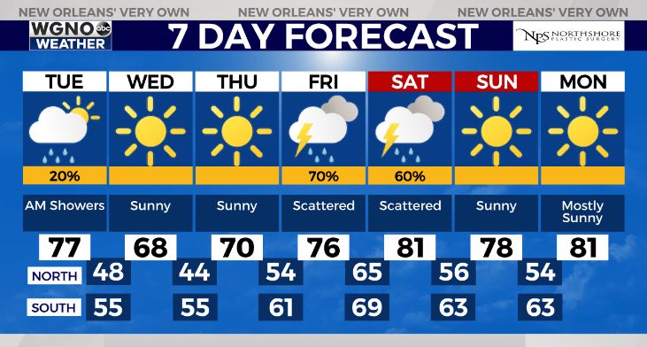
⚠NEW⚠ — Lots of sunshine on the way Tuesday-Thursday along with below average temperatures Wednesday-Thursday.
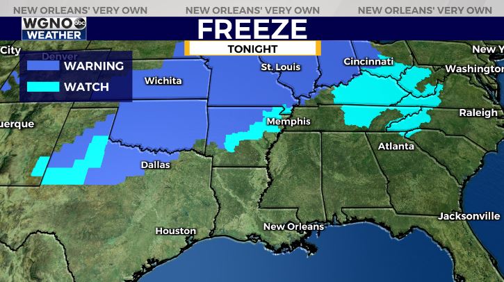
Freeze Warnings extend as far south as Arkansas-Dallas Metro! No freezing temperatures here, but it will be cool/chilly tonight.
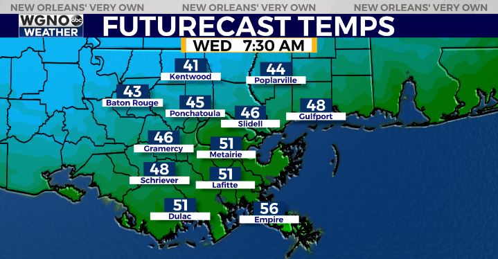
Lows on the Northshore in the low-middle 40s. South of the lake in the low-mid 50s in NOLA Metro, upper 40s-lower 50s in River/Bayou Parishes.
Unfortunately, another severe weather risk looks to develop late week into the first half of the weekend.
The Storm Prediction Center has introduced a Slight Risk(Level 2 out of 5) for severe thunderstorms Friday-Saturday.
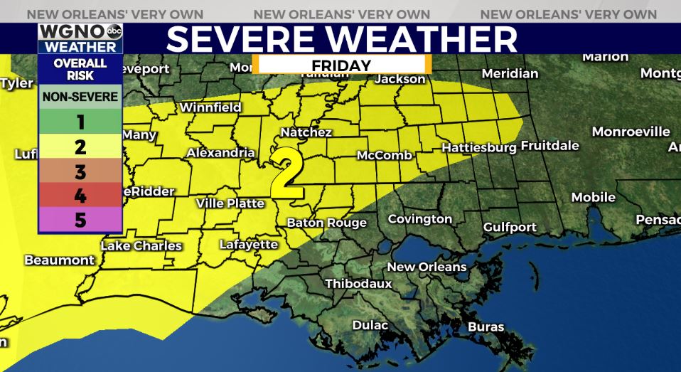
Two rounds of storms possible, one with the warm front late Friday & second on Saturday. Exact timing still unclear. All forms of severe weather appear possible. Right now, it appears the greatest severe risk will be north of I-10/I-12.

For now, enjoy the lovely weather! Stay tuned as we iron out the details as we get closer to the weekend.