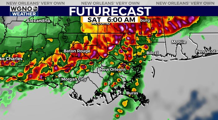
A Severe Thunderstorm Watch is now in effect for areas to the north until 4 AM. We will likely see another watch issued for the rest of the area as the line of storms moves in. Damaging wind gusts will be the main threat although hail and an isolated tornado will also be possible.
The main line of storms will like reach the MS border to the north around 4 AM. It will continue to move south.

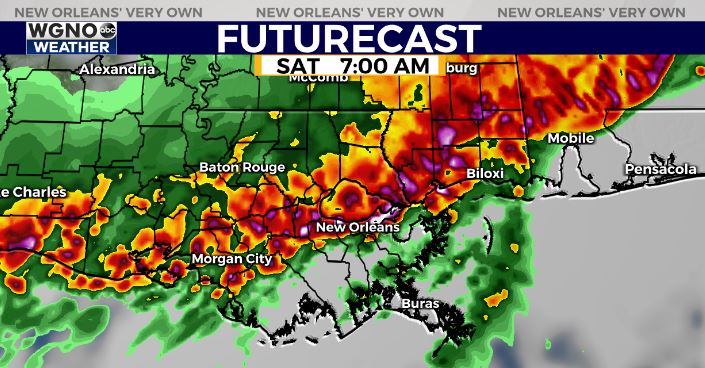
Current models put this in the New Orleans metro area and along I-10 around 7 AM. Some power outages are possible due to the strong winds.

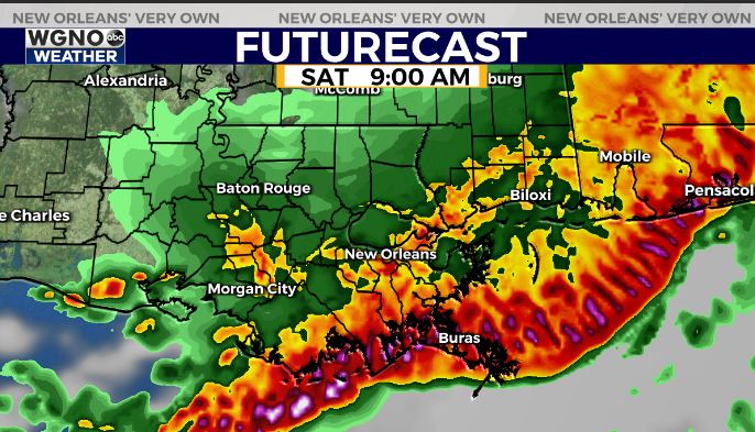
This line will move offshore later in the morning with lingering showers behind it until around noon.

After that we will see drier air move in for Saturday night and Sunday.
As always stick with WGNO on air and online and have a way to receive warnings for your area. Download our new WGNO news app.


