A warm and muggy night is on the way as humidity builds back up from the south. Dewpoints dropped earlier today behind the storms but those numbers are climbing back to around 70 on the south shore.
Look for a few spotty showers as moisture moves in. The best chance will be east of New Orleans. We could also see some patchy fog overnight thanks to more moisture.
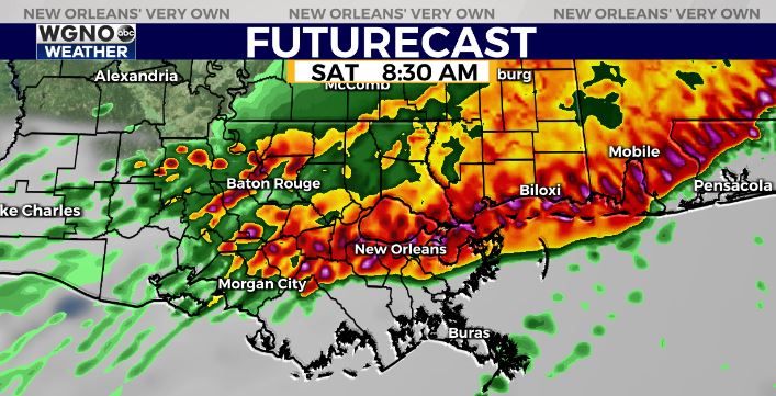
The big story will be another round of strong to severe storms Friday night and Saturday morning. There are still some timing differences within the models, but the general consensus is another big cluster of storms will move through north to south.

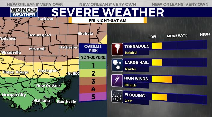
This will be similar to Thursday morning with a strong line of wind and the potential for an isolated tornado. Hail will also be possible.

Right now we have the level 3 risk of severe in the far northern areas with level 2 across the rest of the north shore. However strong winds are possible all the way south to the coast.

Rain will linger across the area through midday Saturday before clearing out. We will have a nice back half of the weekend on Sunday.
As always stay with WGNO on air and online for the latest, and download our new WGNO News App.


