After a quiet & lovely Monday, we’re monitoring another threat for flash flooding & severe weather Tuesday and into Wednesday, with rain continuing into Thursday.
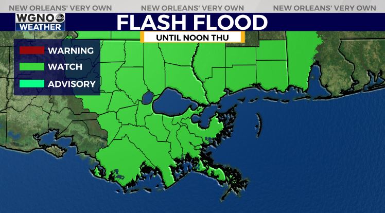
A Flash Flood Watch has been issued until noon Thursday for all of southeast Louisiana and South Mississippi ahead of the anticipated heavy rainfall.
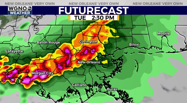
Stalled frontal boundary is providing sufficient lift for thunderstorm development starting now continuing through mid-day!
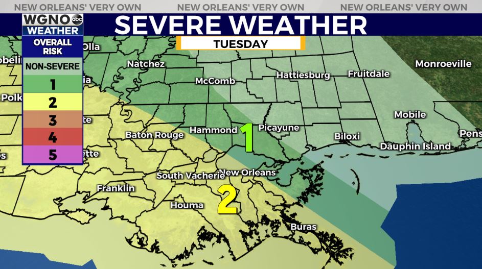
The Storm Prediction Center has upgraded much of south Louisiana to a Slight Risk (Level 2 out of 5) for severe thunderstorms.
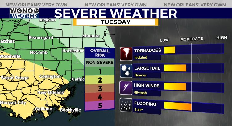
We are forecasting for a primary risk of large hail, gusty winds, and locally heavy rainfall with isolated tornado potential, but this is a low-end risk. A Severe Thunderstorm Watch does remain in effect until 6PM tonight.

Localized heavy rainfall amounts between 2-4″ appears likely, with localized hot spots of 3-6+” possible between Tuesday-Wednesday. Some hot spots of higher amounts will be possible if or where thunderstorms stall out and train.
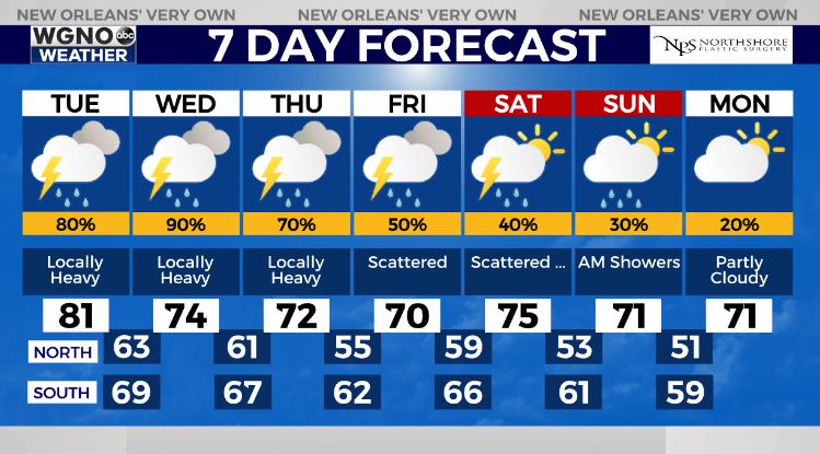
Rain chances still look to remain in the forecast into Friday-Saturday, although the rain coverage looks more scattered rather than numerous. Late Saturday-Sunday looks like the best days of the week!
Check out current conditions near you: https://digital-staging.wgno.com/weather/new-orleans-weather-radar/
Stay up to date with the latest forecast: digital-staging.wgno.com/weather/forecast/
Download the WGNO Weather App to stay connected this hurricane season