
It is a wet and cold afternoon across the area with the front just to the south and rain still moving overhead. The forecast through the first part of the weekend will be a little tricky in terms of temperatures depending on where you are.
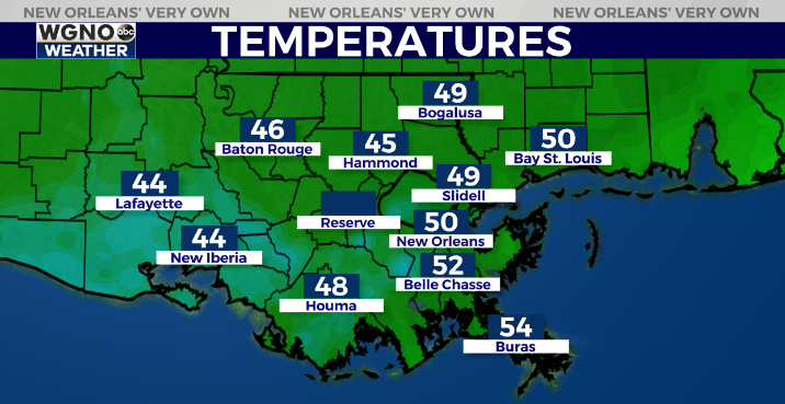
Most of the area Friday afternoon is in the upper 40s to right around 50. These chilly conditions will continue through the evening.
On Saturday it looks like the front begins to try and lift north. Areas south of I-10 could see temperatures reach into the mid 60s while areas along and north of I-12 will likely stay in the mid to upper 50s. Temperatures actually cool back down some Sunday as the rain moves out.
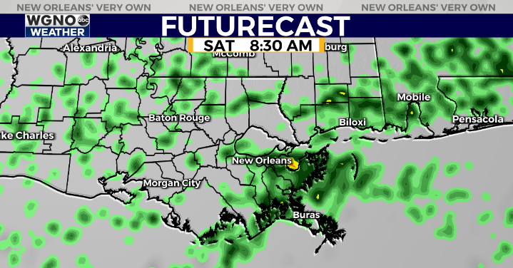
Look for scattered showers to continue on Saturday although no as persistent as what we have seen today. Rain will begin moving out by the evening with drier conditions Sunday.
Temperatures still look to be warming up early in the week.
Check out current conditions near you: https://digital-staging.wgno.com/weather/new-orleans-weather-radar/
Stay up to date with the latest forecast: digital-staging.wgno.com/weather/forecast/
Download the WGNO Weather App to stay connected this hurricane season


