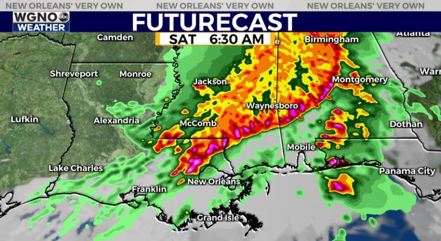
A very active forecast for New Orleans returns with increased storm chances and an enhanced risk (level 3/5) of severe weather being the themes late tonight to early Saturday across Northshore locations and beyond.
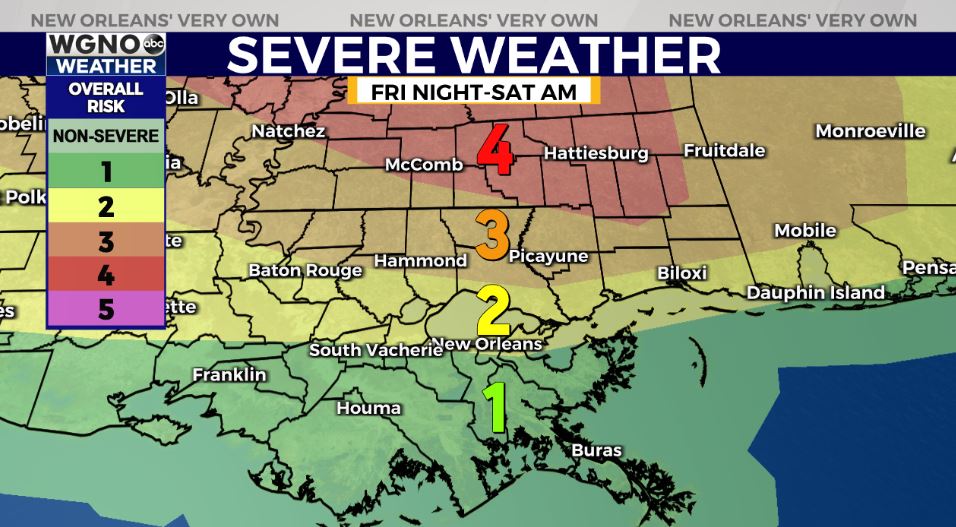
This is of concern across the Louisiana, Mississippi, Alabama, and Florida Gulf Coasts. Here, locally, our next approaching boundary will arrive soon, so we’re monitoring strong thunderstorm potential at that point. Currently, the biggest threat looks to be beyond I-10, north of Louisiana’s state border.
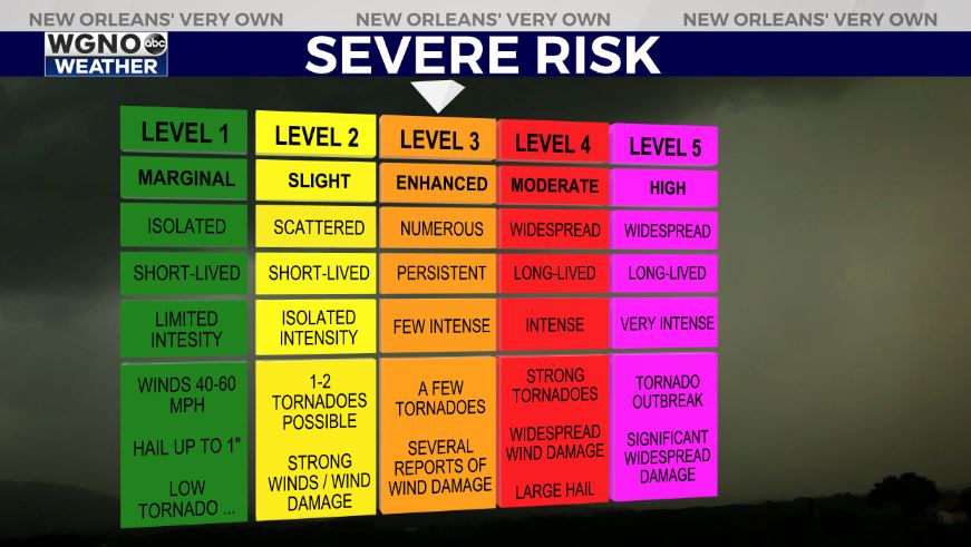
Anticipate an increasing threat for severe thunderstorms as your morning progresses. Damaging winds (60-70 mph), large hail, and isolated tornadoes are a concern. Timeframe will span overnight through afternoon after lunch from west to east, primarily between 2:30AM-9:30AM then maybe later, as well. Rainfall amounts could be between 1-3 inches in total.
Make you sure you have a way to receive watch or warning information on hand incase anything is issued and know the difference between each!
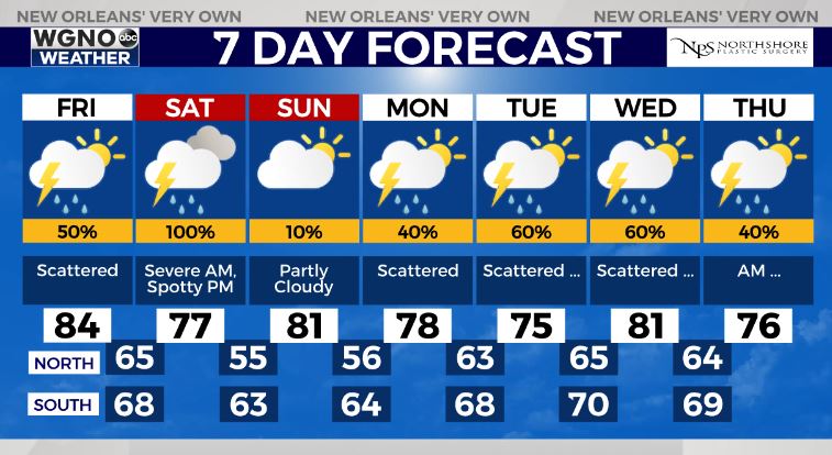
Behind the severe risk, active patterns do return again in your weekly outlook.
Keep up, updates will remain available online on WGNO.com and tonight during WGNO News at 5, 6, and 10.
Check out current conditions near you: https://digital-staging.wgno.com/weather/new-orleans-weather-radar/
Stay up to date with the latest forecast: digital-staging.wgno.com/weather/forecast/
Download the WGNO Weather App to stay connected this hurricane season