This is just the winter that keeps on giving! Earlier today, northern Louisiana was dealing with freezing rain in the region yet again.
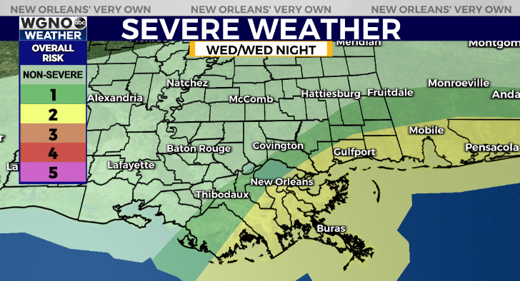
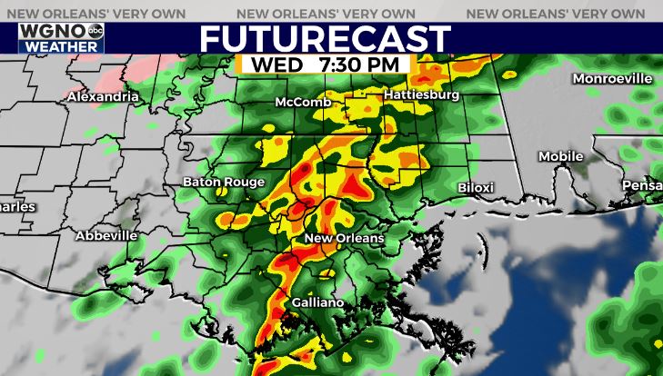
Here, locally, most spots across WGNO’s viewing area are within a “warm sector” of that next approaching storm, hence, we’re monitoring severe weather potential late today to early tonight.

Anticipate an increasing Slight Risk (Level 2 out of 5) for severe thunderstorms as your evening progresses. Damaging winds (45-60 mph), large hail, and isolated tornadoes could be becoming problematic. Timeframe will be between 5PM-9PM from west to east.

The key lacking ingredient in severe weather components is an instability in our atmosphere (heat & humidity) as temperatures will only rebound into the upper 50s, near 60 across New Orleans.
Behind the severe risk, much colder air will return again in these next few days. Expecting another moderate to hard freeze north of the lake Thursday night plus Friday night, so some additional preparations remain necessary.
Check out current conditions near you: https://digital-staging.wgno.com/weather/new-orleans-weather-radar/
Stay up to date with the latest forecast: digital-staging.wgno.com/weather/forecast/
Download the WGNO Weather App to stay connected this hurricane season


