Finally, another gorgeous day today across New Orleans and southeast Louisiana as conditions are warmer than we were these past couple of afternoons!
Warmth remains the theme ahead until late week! Single word that sums up upcoming weather patterns: LAYERS!
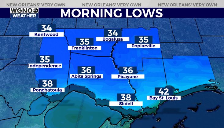
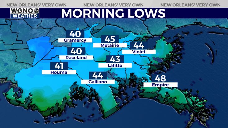
Northshore residents wake up tomorrow to upper 30s outside their windows, however, Southshore residents can expect lower 40s! Highs reach upper 60s to lower 70s by your afternoon after lunch.


Great conditions tomorrow to get outside after a frigid week indoors! Another front arrives early Monday, which means rain chances go up at that point.
Right now, no wintery precipitation or freezes look possible again in the near future, thank goodness! This is a much welcome seven day forecast after that bitter cold week we just said goodbye to!
Keep up, updates remain available online on WGNO.com and during WGNO News at 6 or 10!
Check out current conditions near you: https://digital-staging.wgno.com/weather/new-orleans-weather-radar/
Stay up to date with the latest forecast: digital-staging.wgno.com/weather/forecast/
Download the WGNO Weather App to stay connected this hurricane season


