5:00AM FORECAST from Meteorologist Scot Pilie — Flash Flood Watch in effect. Clean storm drains! Here’s the breakdown:
Growing more concerned with the flash flood potential over the next few days, specifically Tuesday as slow moving round of storms appears likely.

FLASH FLOOD WATCH — issued from 8AM Tuesday until 12AM Friday ahead of threatening heavy rain in Louisiana.
Please clear catch basins & storm drains! Park vehicles up on Neutral Ground if you’re in flood prone location. Restrictions are lifted in NOLA!
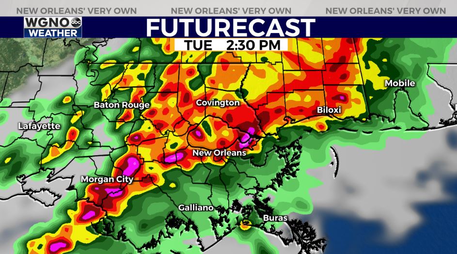
While it’s impossible to predict exactly where the heaviest rain will drop, high res guidance locking in on potential for “training” of storms with 2-5+” of rain likely Tuesday-Tuesday evening with localized higher amounts likely.
Again Wednesday, intermittent rounds of heavy rain possible in southeast Louisiana.
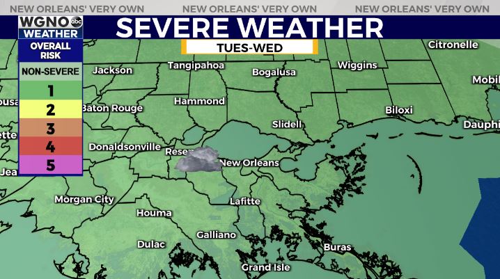
In addition, a low-end Marginal Risk(Level 1 out of 5) for a few strong thunderstorms. Main risk of gusty winds, hail, & isolated tornado risk.
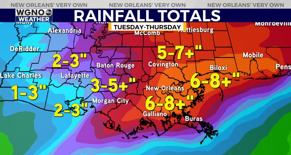
Over the next 3 days, 4-6″ rainfall amounts appear likely for SE LA with localized 6-10+” amounts possible. It won’t rain non-stop, and there will be breaks. Hopefully it comes in rounds/waves to mitigate flash flood issues.
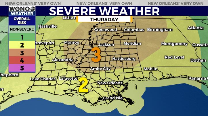
By Thursday, forecast models diverge on the details. Some models showcase the rain risk & severe risk staying further north. Still giving a 60-70% chance of thunderstorms, with a Slight Risk(Level 2 out of 5) risk for severe weather as well. Main risk of gusty winds & isolated tornado threat.


