
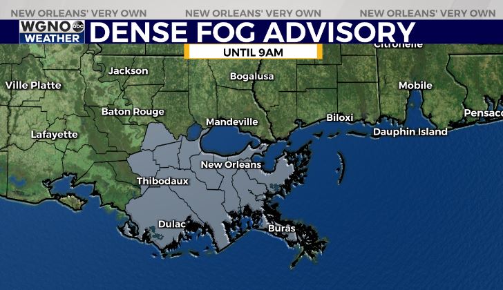
5:00AM VIDEO FORECAST from Meteorologist Scot Pilie — Patchy dense fog to kick off you Tuesday, especially south of I-10. Dense fog advisory issued until 9AM for the Southshore.
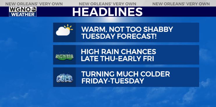
Spring-like forecast set to continue through Thursday!
High temperatures in the middle 70s, with some spots into the mid-upper 70s.

Rain chances will be spotty on Wednesday, but higher rain chances look to arrive Thursday-Friday morning with the arrival of our next cold front. Rainfall amounts of 1-2″ expected with localized higher amounts possible.
In the wake of this cold front, much colder air looks to spill into Louisiana.
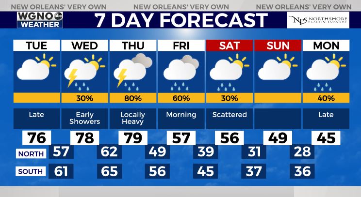
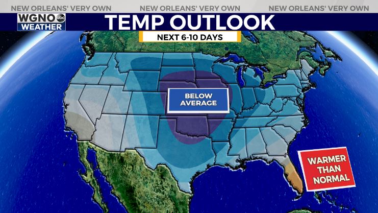
The takeaway? Forecast guidance continues to suggest well below average temperatures for Louisiana this weekend into early next week, but the duration & intensity of the cold snap remains in question. Certainly looks like gumbo warning criteria…![]() and some guidance suggests a damaging freeze possible.
and some guidance suggests a damaging freeze possible.
As far as wintry mischief, until the temperature forecast becomes more concrete, take any model guidance showing wintry precip with a BIG grain of salt. It’s certainly worth watching the pattern late weekend into next week as things become more clear. Stay tuned!


