This is an archived article and the information in the article may be outdated. Please look at the time stamp on the story to see when it was last updated.
5:30AM VIDEO FORECAST from Meteorologist Scot Pilie — Flash Flood Warning for Metro New Orleans. Please avoid travel if possible.
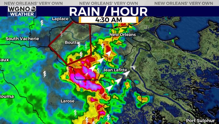
Very heavy rainfall moving into Metro New Orleans. Watch for quick 1-3″ of rainfall in short period of time! Street flooding will be possible.
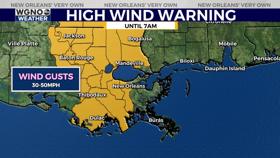
HIGH WIND WARNING — Extended until 7AM for much of southeast Louisiana. Wind gusts 30-50mph.
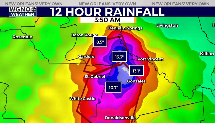
FLASH FLOOD EMERGENCY — Continues for areas just southeast of Baton Rouge from Gonzales to Donaldsonville. 10-14″ of rainfall has fallen, leading to impassable roadways. High water rescues ongoing.
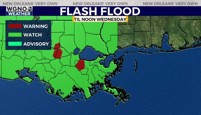
Flash Flood Watch remains in effect through noon on Wednesday. Be aware of additional 2-4″ of rainfall with localized higher amounts in locations where thunderstorms train.