This is an archived article and the information in the article may be outdated. Please look at the time stamp on the story to see when it was last updated.
Another night of unseasonably cold temperatures is on the way. Look for mid to upper 30s north and mid 40s south. Patchy frost will be possible again on Saturday morning in the colder spots. Less wind means temperatures will be dropping very quickly once the sun goes down.
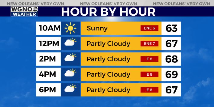
After that look for another beautiful day Saturday. We are going to be in the upper 60s most of the day with highs topping out around 70.
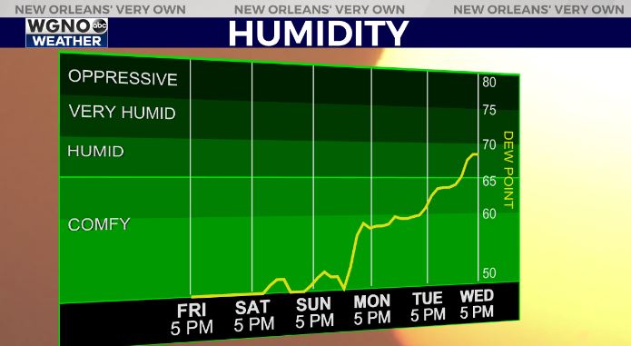
Humidity stays very low through the weekend. It begins to climb next week as southerly flow picks back up. Rain chances will also come back briefly on Tuesday.
We will also see warmer temperatures next week with temps back to around 80 by Wednesday.


