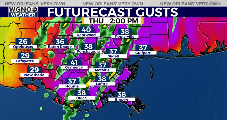
5:45AM VIDEO FORECAST from Meteorologist Scot Pilie — Windy Thursday! Wind Advisory issued from 9AM until 6PM. Wind gusts of 25-40mph likely.
Few strong to severe thunderstorms possible. Here’s the breakdown:
A strong upper-level low pressure system will bring a severe weather outbreak possible to parts of Mississippi, Alabama, and Tennessee.
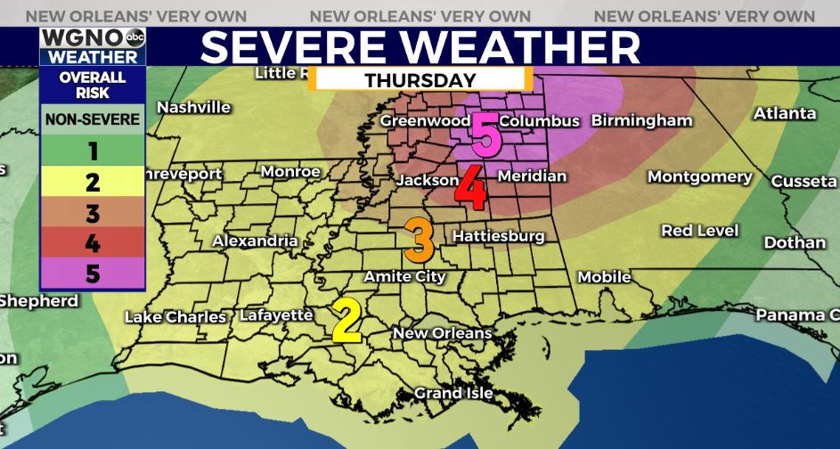
A HIGH(Level 5 out of 5) Risk for severe storms has been placed there.
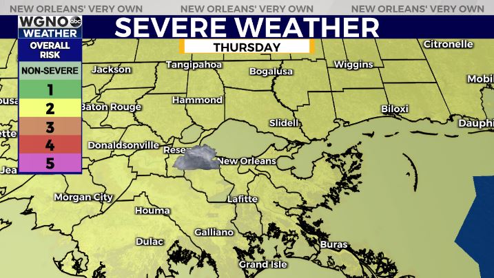
For southeast Louisiana and South Mississippi, a much lower risk for severe storms. A Slight(Level 2 out of 5) for severe storms. Main time frame for any strong to severe storms would be from 11AM until 4PM.
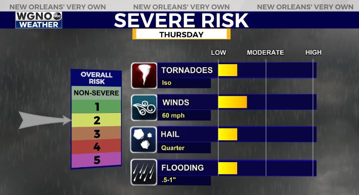
Main risks of damaging winds, large hail, and isolated tornado report. In fact, rain chances aren’t all that high today as some spots may even stay dry.
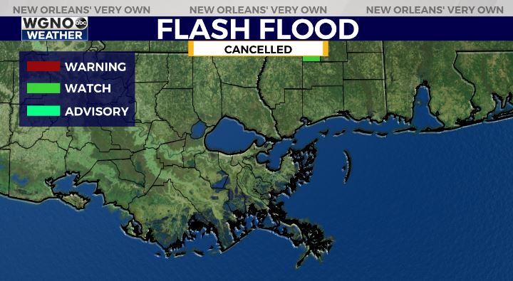
The good news? Flash Flood Watch CANCELLED! A few scattered strong storms remain possible today across southeast Louisiana, but heaviest rain threat has ended!


