Finally, another gorgeous day today across New Orleans and southeast Louisiana as conditions are warmer than we were these past couple of afternoons! Sunny and 70s is pretty tough to beat during February, especially after that bitter cold forecast for last week we survived!
Warmth remains the theme ahead! Single word that sums up upcoming weather patterns: LAYERS!
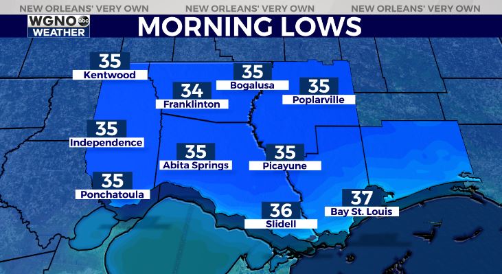
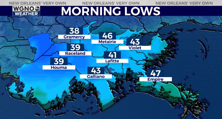
Northshore residents wake up tomorrow to upper 30s outside their windows, however, Southshore residents can expect lower 40s! Highs reach upper 60s to lower 70s again by your afternoon after lunch.
Last night’s front will make its presence known as far as temperatures early Tuesday. High pressure is currently responsible for our sunshine outside, but the colder air moves in later tonight to early morning. Another front arrives late week, meaning rain chances go up at that point.
2 words: GO! OUTSIDE! Keep up, updates remain available online on WGNO.com and tonight during WGNO News at 10 P.M.
Check out current conditions near you: https://digital-staging.wgno.com/weather/new-orleans-weather-radar/
Stay up to date with the latest forecast: digital-staging.wgno.com/weather/forecast/
Download the WGNO Weather App to stay connected this hurricane season